Aktau geodata
Aktau (Mangghystaū) is a seat of a first-order administrative division; located in Kazakhstan in Asia/Aqtau (GMT+5) time zone. With population of 147,443 people, there are 15 cities with bigger population in this country. Compared to other cities in Kazakhstan, 81.5% of cities are located further ↑North; 95.9% of cities are located further →East and 94.8% of cities have higher elevation than Aktau. Note1


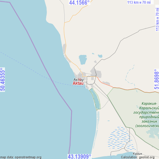
Aktau GPS coordinates[2]
43° 39' 0" North, 51° 10' 0.012" East
| Map corner | latitude | longitude |
|---|---|---|
| Upper-left | 44.1566°, | 50.46355° |
| Center: | 43.65°, | 51.16667° |
| Lower-right: | 43.13909°, | 51.8698° |
| Map W x H: | 113.1×113.1 km | = 70.3×70.3mi |
| max Lat: | 54.90596° ⇑81.5% North |
| Aktau: | 43.65° |
| min Lat: | ⇓18.5% South 40.66338° |
| min Long | Aktau | max Long |
| 46.83361° | 51.16667° | 84.87144° |
| W 4.1%⇐ | ⇒95.9% E |
Elevation
Elevation of Aktau is -5 m = -16 ft, and this is 361.5 m = 1186 ft below average elevation for this country.
| Max E: |
1847 m = 6060 ft | 94.8% |
| Avg. | 356.5 m = 1170 ft | |
| Aktau | -5 m = -16 ft | |
Min E: |
-26 m = -85 ft | 5.2% |
See also: Aktau elevation on elevation.city.
Geographical zone
Aktau is located in North temperate zone (between Tropic of Cancer and the Arctic Circle). Distance of this Northern Tropic circle is 2247.5 km =1396.5 mi to South.| Distance of | km | miles | from Aktau |
|---|---|---|---|
| North Pole | 5153.6 | 3202.3 | to North |
| Arctic Circle | 2547.7 | 1583.1 | to North |
| Tropic Cancer | 2247.5 | 1396.5 | to South |
| Equator | 4853.4 | 3015.8 | to South |


Nearby cities:
14 places around Aktau: (largest is in red/bold)
• Atyrau
389.5 km =242 mi,  8°
8°
• Balykshi
383.8 km =238.5 mi, 8°
• Baūtīno
123.7 km =76.9 mi,  323°
323°
• Fort-Shevchenko
119.5 km =74.3 mi, 322°
• Maloye Ganyushkino
360.3 km =223.9 mi,  335°
335°
• Munayshy
77.9 km =48.4 mi,  103°
103°
• Qaraton
359.3 km =223.3 mi,  30°
30°
• Sayötesh
203.7 km =126.6 mi,  68°
68°
• Shetpe
95.3 km =59.2 mi,  52°
52°
• Taūshyq
78.8 km =49 mi, 10°
• Yeraliyev
66.7 km =41.4 mi,  141°
141°
• Zhanaozen
141 km =87.6 mi, 104°
• Zhetibay
73.7 km =45.8 mi,  94°
94°
• Ömirzaq
8.4 km =5.2 mi,  133°
133°
In other languages:
- In France: Aktaou
- In German: Aqtau
- In Italian: Aqtau
- In Russian: Актау
- In Chinese: 阿克套
Sources, notices
• [Note1] Compared only with cities in Kazakhstan existing in our database
• [Src1] Map data: © OpenStreetMap contributors (CC-BY-SA)
• [Src2] Other city data from geonames.org with taken over terms of usage.
• [Src3] Geographical zone / Annual Mean Temperature by Robert A. Rohde @ Wikipedia
