Munayshy geodata
Munayshy (Mangghystaū) is a populated place; located in Kazakhstan in Asia/Aqtau (GMT+5) time zone. With population of 4,085 people, there are 211 cities with bigger population in this country. Compared to other cities in Kazakhstan, 84.4% of cities are located further ↑North; 91.1% of cities are located further →East and 78.5% of cities have higher elevation than Munayshy. Note1


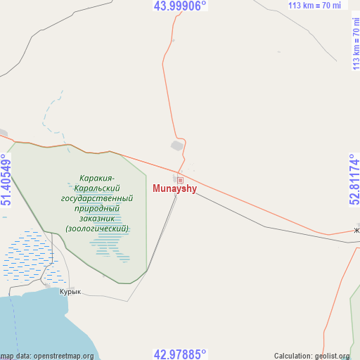
Munayshy GPS coordinates[2]
43° 29' 27.996" North, 52° 6' 30.996" East
| Map corner | latitude | longitude |
|---|---|---|
| Upper-left | 43.99906°, | 51.40549° |
| Center: | 43.49111°, | 52.10861° |
| Lower-right: | 42.97885°, | 52.81174° |
| Map W x H: | 113.4×113.4 km | = 70.5×70.5mi |
| max Lat: | 54.90596° ⇑84.4% North |
| Munayshy: | 43.49111° |
| min Lat: | ⇓15.6% South 40.66338° |
| min Long | Munayshy | max Long |
| 46.83361° | 52.10861° | 84.87144° |
| W 8.9%⇐ | ⇒91.1% E |
Elevation
Elevation of Munayshy is 129 m = 423 ft, and this is 227.5 m = 746 ft below average elevation for this country.
| Max E: |
1847 m = 6060 ft | 78.5% |
| Avg. | 356.5 m = 1170 ft | |
| Munayshy | 129 m = 423 ft | |
Min E: |
-26 m = -85 ft | 21.5% |
See also: Kazakhstan elevation on elevation.city.
Geographical zone
Munayshy is located in North temperate zone (between Tropic of Cancer and the Arctic Circle). Distance of this Northern Tropic circle is 2229.8 km =1385.5 mi to South.| Distance of | km | miles | from Munayshy |
|---|---|---|---|
| North Pole | 5171.3 | 3213.3 | to North |
| Arctic Circle | 2565.4 | 1594.1 | to North |
| Tropic Cancer | 2229.8 | 1385.5 | to South |
| Equator | 4835.8 | 3004.8 | to South |


Nearby cities:
15 places around Munayshy: (largest is in red/bold)
• Aktau
77.9 km =48.4 mi,  283°
283°
• Atyrau
403.5 km =250.7 mi,  357°
357°
• Balykshi
398 km =247.3 mi, 357°
• Baūtīno
189.5 km =117.7 mi,  308°
308°
• Beyneu
318.6 km =198 mi,  50°
50°
• Fort-Shevchenko
185.8 km =115.5 mi, 307°
• Qaraton
344.8 km =214.2 mi,  18°
18°
• Qulsary
413 km =256.6 mi, 21°
• Sayötesh
147.2 km =91.5 mi, 50°
• Shetpe
75.1 km =46.7 mi,  0°
0°
• Taūshyq
112.9 km =70.2 mi,  327°
327°
• Yeraliyev
48.9 km =30.4 mi,  225°
225°
• Zhanaozen
63.1 km =39.2 mi,  105°
105°
• Zhetibay
11.7 km =7.3 mi,  348°
348°
• Ömirzaq
70.9 km =44.1 mi, 279°
Sources, notices
• [Note1] Compared only with cities in Kazakhstan existing in our database
• [Src1] Map data: © OpenStreetMap contributors (CC-BY-SA)
• [Src2] Other city data from geonames.org with taken over terms of usage.
• [Src3] Geographical zone / Annual Mean Temperature by Robert A. Rohde @ Wikipedia
