Zhetibay geodata
Zhetibay (Mangghystaū) is a populated place; located in Kazakhstan in Asia/Aqtau (GMT+5) time zone. With population of 11,731 people, there are 102 cities with bigger population in this country. Compared to other cities in Kazakhstan, 82.6% of cities are located further ↑North; 91.5% of cities are located further →East and 75.2% of cities have higher elevation than Zhetibay. Note1


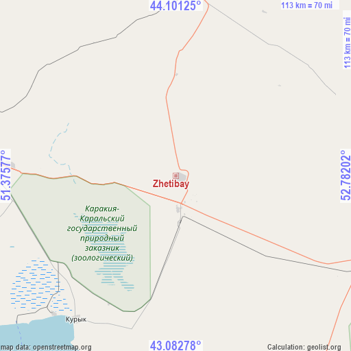
Zhetibay GPS coordinates[2]
43° 35' 39.012" North, 52° 4' 44.004" East
| Map corner | latitude | longitude |
|---|---|---|
| Upper-left | 44.10125°, | 51.37577° |
| Center: | 43.59417°, | 52.07889° |
| Lower-right: | 43.08278°, | 52.78202° |
| Map W x H: | 113.2×113.2 km | = 70.3×70.3mi |
| max Lat: | 54.90596° ⇑82.6% North |
| Zhetibay: | 43.59417° |
| min Lat: | ⇓17.4% South 40.66338° |
| min Long | Zhetibay | max Long |
| 46.83361° | 52.07889° | 84.87144° |
| W 8.5%⇐ | ⇒91.5% E |
Elevation
Elevation of Zhetibay is 144 m = 472 ft, and this is 212.5 m = 697 ft below average elevation for this country.
| Max E: |
1847 m = 6060 ft | 75.2% |
| Avg. | 356.5 m = 1170 ft | |
| Zhetibay | 144 m = 472 ft | |
Min E: |
-26 m = -85 ft | 24.8% |
See also: Kazakhstan elevation on elevation.city.
Geographical zone
Zhetibay is located in North temperate zone (between Tropic of Cancer and the Arctic Circle). Distance of this Northern Tropic circle is 2241.3 km =1392.7 mi to South.| Distance of | km | miles | from Zhetibay |
|---|---|---|---|
| North Pole | 5159.8 | 3206.2 | to North |
| Arctic Circle | 2554 | 1587 | to North |
| Tropic Cancer | 2241.3 | 1392.7 | to South |
| Equator | 4847.2 | 3011.9 | to South |


Nearby cities:
15 places around Zhetibay: (largest is in red/bold)
• Aktau
73.7 km =45.8 mi,  274°
274°
• Atyrau
392 km =243.6 mi,  357°
357°
• Balykshi
386.5 km =240.2 mi, 357°
• Baūtīno
180.6 km =112.2 mi,  305°
305°
• Beyneu
313.1 km =194.6 mi,  52°
52°
• Fort-Shevchenko
177 km =110 mi,  304°
304°
• Munayshy
11.7 km =7.3 mi,  168°
168°
• Qaraton
334.7 km =208 mi,  19°
19°
• Qulsary
403.1 km =250.5 mi, 22°
• Sayötesh
142.1 km =88.3 mi, 54°
• Shetpe
63.7 km =39.6 mi,  2°
2°
• Taūshyq
102 km =63.4 mi,  325°
325°
• Yeraliyev
56.1 km =34.9 mi,  214°
214°
• Zhanaozen
69.2 km =43 mi,  113°
113°
• Ömirzaq
67.4 km =41.9 mi, 270°
Sources, notices
• [Note1] Compared only with cities in Kazakhstan existing in our database
• [Src1] Map data: © OpenStreetMap contributors (CC-BY-SA)
• [Src2] Other city data from geonames.org with taken over terms of usage.
• [Src3] Geographical zone / Annual Mean Temperature by Robert A. Rohde @ Wikipedia
