Ayagoz geodata
Ayagoz (East Kazakhstan) is a populated place; located in Kazakhstan in Asia/Almaty (GMT+5) time zone. With population of 33,479 people, there are 49 cities with bigger population in this country. Compared to other cities in Kazakhstan, 56.3% of cities are located further ↑North; 89.3% of cities are located further ←West and 87% of cities have lower elevation than Ayagoz. Note1


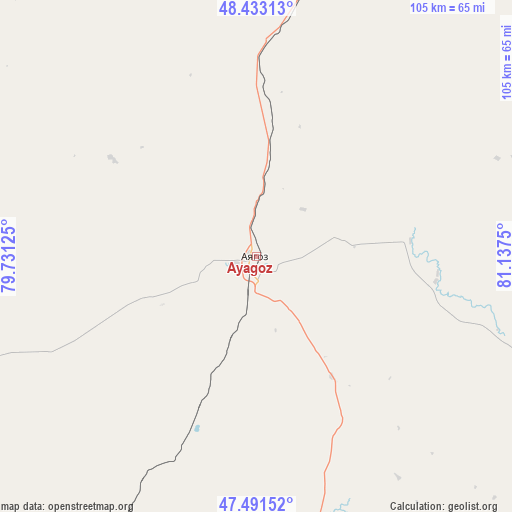
Ayagoz GPS coordinates[2]
47° 57' 52.092" North, 80° 26' 3.732" East
| Map corner | latitude | longitude |
|---|---|---|
| Upper-left | 48.43313°, | 79.73125° |
| Center: | 47.96447°, | 80.43437° |
| Lower-right: | 47.49152°, | 81.1375° |
| Map W x H: | 104.7×104.7 km | = 65.1×65.1mi |
| max Lat: | 54.90596° ⇑56.3% North |
| Ayagoz: | 47.96447° |
| min Lat: | ⇓43.7% South 40.66338° |
| min Long | Ayagoz | max Long |
| 46.83361° | 80.43437° | 84.87144° |
| W 89.3%⇐ | ⇒10.7% E |
Elevation
Elevation of Ayagoz is 665 m = 2182 ft, and this is 308.5 m = 1012 ft above average elevation for this country.
| Max E: |
1847 m = 6060 ft | 13% |
| Ayagoz | 665 m 2182 ft | |
| Avg. | 356.5 m = 1170 ft | |
Min E: |
-26 m = -85 ft | 87% |
See also: Kazakhstan elevation on elevation.city.
Geographical zone
Ayagoz is located in North temperate zone (between Tropic of Cancer and the Arctic Circle). Distance of this North polar circle is 2068 km =1285 mi to North.| Distance of | km | miles | from Ayagoz |
|---|---|---|---|
| North Pole | 4673.9 | 2904.2 | to North |
| Arctic Circle | 2068 | 1285 | to North |
| Tropic Cancer | 2727.2 | 1694.6 | to South |
| Equator | 5333.1 | 3313.8 | to South |


Nearby cities:
15 places around Ayagoz: (largest is in red/bold)
• Aksuat
255.4 km =158.7 mi,  70°
70°
• Aqtoghay
126.7 km =78.7 mi,  207°
207°
• Auezov
211.4 km =131.4 mi,  23°
23°
• Belogorskīy
260.6 km =161.9 mi,  49°
49°
• Georgīevka
173.1 km =107.6 mi,  28°
28°
• Kokpekty
169.5 km =105.3 mi,  58°
58°
• Kurchum
248 km =154.1 mi, 74°
• Lepsy
222.9 km =138.5 mi, 210°
• Priisk Boko
151 km =93.8 mi,  36°
36°
• Qaraūyl
139.5 km =86.7 mi,  321°
321°
• Sarykamys
129.7 km =80.6 mi,  261°
261°
• Shar
186 km =115.6 mi,  14°
14°
• Suykbulak
199 km =123.7 mi, 13°
• Urzhar
132.1 km =82.1 mi,  137°
137°
• Zhalghyztobe
150 km =93.2 mi, 22°
Sources, notices
• [Note1] Compared only with cities in Kazakhstan existing in our database
• [Src1] Map data: © OpenStreetMap contributors (CC-BY-SA)
• [Src2] Other city data from geonames.org with taken over terms of usage.
• [Src3] Geographical zone / Annual Mean Temperature by Robert A. Rohde @ Wikipedia
