Kurchatov geodata
Kurchatov (East Kazakhstan) is a populated place; located in Kazakhstan in Asia/Almaty (GMT+5) time zone. With population of 10,747 people, there are 108 cities with bigger population in this country. Compared to other cities in Kazakhstan, 73% of cities are located further ↓South; 84.8% of cities are located further ←West and 73% of cities have higher elevation than Kurchatov. Note1


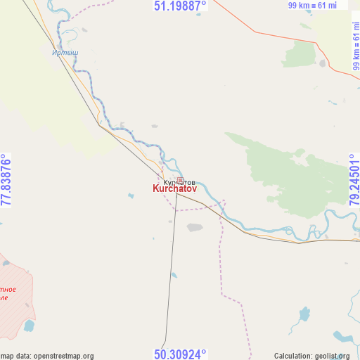
Kurchatov GPS coordinates[2]
50° 45' 22.212" North, 78° 32' 30.768" East
| Map corner | latitude | longitude |
|---|---|---|
| Upper-left | 51.19887°, | 77.83876° |
| Center: | 50.75617°, | 78.54188° |
| Lower-right: | 50.30924°, | 79.24501° |
| Map W x H: | 98.9×98.9 km | = 61.5×61.5mi |
| max Lat: | 54.90596° ⇑27% North |
| Kurchatov: | 50.75617° |
| min Lat: | ⇓73% South 40.66338° |
| min Long | Kurchatov | max Long |
| 46.83361° | 78.54188° | 84.87144° |
| W 84.8%⇐ | ⇒15.2% E |
Elevation
Elevation of Kurchatov is 165 m = 541 ft, and this is 191.5 m = 628 ft below average elevation for this country.
| Max E: |
1847 m = 6060 ft | 73% |
| Avg. | 356.5 m = 1170 ft | |
| Kurchatov | 165 m = 541 ft | |
Min E: |
-26 m = -85 ft | 27% |
See also: Kazakhstan elevation on elevation.city.
Geographical zone
Kurchatov is located in North temperate zone (between Tropic of Cancer and the Arctic Circle). Distance of this North polar circle is 1757.6 km =1092.1 mi to North.| Distance of | km | miles | from Kurchatov |
|---|---|---|---|
| North Pole | 4363.5 | 2711.4 | to North |
| Arctic Circle | 1757.6 | 1092.1 | to North |
| Tropic Cancer | 3037.6 | 1887.5 | to South |
| Equator | 5643.6 | 3506.8 | to South |


Nearby cities:
15 places around Kurchatov: (largest is in red/bold)
• Aksu
181.4 km =112.7 mi,  321°
321°
• Bayanaul
199.8 km =124.1 mi,  271°
271°
• Belogor’ye
113.9 km =70.8 mi, 319°
• Borodulikha
168.1 km =104.5 mi,  91°
91°
• Kalkaman
219.6 km =136.5 mi,  307°
307°
• Leninskiy
206.3 km =128.2 mi, 323°
• Mayqayyng
206.6 km =128.4 mi,  292°
292°
• Pavlodar
201.8 km =125.4 mi,  327°
327°
• Qaraūyl
207.8 km =129.1 mi,  165°
165°
• Semey
127.1 km =79 mi,  106°
106°
• Shar
220.8 km =137.2 mi,  126°
126°
• Shemonaīkha
237.8 km =147.8 mi, 93°
• Suykbulak
213 km =132.4 mi,  123°
123°
• Zhezkent
198.9 km =123.6 mi,  84°
84°
• Ūst’-Talovka
234.3 km =145.6 mi,  95°
95°
Sources, notices
• [Note1] Compared only with cities in Kazakhstan existing in our database
• [Src1] Map data: © OpenStreetMap contributors (CC-BY-SA)
• [Src2] Other city data from geonames.org with taken over terms of usage.
• [Src3] Geographical zone / Annual Mean Temperature by Robert A. Rohde @ Wikipedia
