Mayqayyng geodata
Mayqayyng (Pavlodar Region) is a populated place; located in Kazakhstan in Asia/Almaty (GMT+5) time zone. With population of 7,695 people, there are 147 cities with bigger population in this country. Compared to other cities in Kazakhstan, 78.1% of cities are located further ↓South; 75.9% of cities are located further ←West and 58.1% of cities have higher elevation than Mayqayyng. Note1


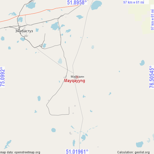
Mayqayyng GPS coordinates[2]
51° 27' 35.316" North, 75° 48' 8.352" East
| Map corner | latitude | longitude |
|---|---|---|
| Upper-left | 51.8958°, | 75.0992° |
| Center: | 51.45981°, | 75.80232° |
| Lower-right: | 51.01961°, | 76.50545° |
| Map W x H: | 97.4×97.4 km | = 60.5×60.5mi |
| max Lat: | 54.90596° ⇑21.9% North |
| Mayqayyng: | 51.45981° |
| min Lat: | ⇓78.1% South 40.66338° |
| min Long | Mayqayyng | max Long |
| 46.83361° | 75.80232° | 84.87144° |
| W 75.9%⇐ | ⇒24.1% E |
Elevation
Elevation of Mayqayyng is 260 m = 853 ft, and this is 96.5 m = 317 ft below average elevation for this country.
| Max E: |
1847 m = 6060 ft | 58.1% |
| Avg. | 356.5 m = 1170 ft | |
| Mayqayyng | 260 m = 853 ft | |
Min E: |
-26 m = -85 ft | 41.9% |
See also: Kazakhstan elevation on elevation.city.
Geographical zone
Mayqayyng is located in North temperate zone (between Tropic of Cancer and the Arctic Circle). Distance of this North polar circle is 1679.4 km =1043.5 mi to North.| Distance of | km | miles | from Mayqayyng |
|---|---|---|---|
| North Pole | 4285.3 | 2662.8 | to North |
| Arctic Circle | 1679.4 | 1043.5 | to North |
| Tropic Cancer | 3115.9 | 1936.1 | to South |
| Equator | 5721.8 | 3555.4 | to South |


Nearby cities:
15 places around Mayqayyng: (largest is in red/bold)
• Aksu
100.8 km =62.6 mi,  50°
50°
• Bayanaul
74.5 km =46.3 mi,  185°
185°
• Belogor’ye
115.8 km =72 mi,  86°
86°
• Bestobe
218.3 km =135.6 mi,  301°
301°
• Ekibastuz
44.2 km =27.5 mi,  311°
311°
• Irtyshsk
209.7 km =130.3 mi,  353°
353°
• Kalkaman
57 km =35.4 mi,  15°
15°
• Kurchatov
206.6 km =128.4 mi,  112°
112°
• Kushoky
217 km =134.8 mi,  230°
230°
• Leninskiy
111 km =69 mi,  37°
37°
• Pavlodar
121.5 km =75.5 mi, 41°
• Prigorodnoye
197.1 km =122.5 mi,  184°
184°
• Qarqaraly
228.8 km =142.2 mi, 185°
• Qashyr
179.8 km =111.7 mi,  6°
6°
• Yermentau
187.6 km =116.6 mi,  275°
275°
Sources, notices
• [Note1] Compared only with cities in Kazakhstan existing in our database
• [Src1] Map data: © OpenStreetMap contributors (CC-BY-SA)
• [Src2] Other city data from geonames.org with taken over terms of usage.
• [Src3] Geographical zone / Annual Mean Temperature by Robert A. Rohde @ Wikipedia
