Kalkaman geodata
Kalkaman (Pavlodar Region) is a populated place; located in Kazakhstan in Asia/Almaty (GMT+5) time zone. With population of 5,415 people, there are 183 cities with bigger population in this country. Compared to other cities in Kazakhstan, 81.9% of cities are located further ↓South; 76.3% of cities are located further ←West and 80% of cities have higher elevation than Kalkaman. Note1


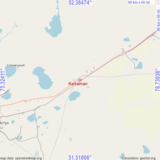
Kalkaman GPS coordinates[2]
51° 57' 12.564" North, 76° 1' 38.028" East
| Map corner | latitude | longitude |
|---|---|---|
| Upper-left | 52.38474°, | 75.32411° |
| Center: | 51.95349°, | 76.02723° |
| Lower-right: | 51.51806°, | 76.73036° |
| Map W x H: | 96.4×96.4 km | = 59.9×59.9mi |
| max Lat: | 54.90596° ⇑18.1% North |
| Kalkaman: | 51.95349° |
| min Lat: | ⇓81.9% South 40.66338° |
| min Long | Kalkaman | max Long |
| 46.83361° | 76.02723° | 84.87144° |
| W 76.3%⇐ | ⇒23.7% E |
Elevation
Elevation of Kalkaman is 122 m = 400 ft, and this is 234.5 m = 769 ft below average elevation for this country.
| Max E: |
1847 m = 6060 ft | 80% |
| Avg. | 356.5 m = 1170 ft | |
| Kalkaman | 122 m = 400 ft | |
Min E: |
-26 m = -85 ft | 20% |
See also: Kazakhstan elevation on elevation.city.
Geographical zone
Kalkaman is located in North temperate zone (between Tropic of Cancer and the Arctic Circle). Distance of this North polar circle is 1624.5 km =1009.4 mi to North.| Distance of | km | miles | from Kalkaman |
|---|---|---|---|
| North Pole | 4230.4 | 2628.6 | to North |
| Arctic Circle | 1624.5 | 1009.4 | to North |
| Tropic Cancer | 3170.8 | 1970.2 | to South |
| Equator | 5776.7 | 3589.5 | to South |


Nearby cities:
15 places around Kalkaman: (largest is in red/bold)
• Aksu
62.4 km =38.8 mi,  81°
81°
• Bayanaul
131 km =81.4 mi,  189°
189°
• Belogor’ye
110 km =68.4 mi,  115°
115°
• Bestobe
208.6 km =129.6 mi,  286°
286°
• Ekibastuz
54.7 km =34 mi,  242°
242°
• Irtyshsk
158.2 km =98.3 mi,  345°
345°
• Kurchatov
219.6 km =136.5 mi,  127°
127°
• Kushoky
265.1 km =164.7 mi,  223°
223°
• Leninskiy
61.4 km =38.2 mi,  57°
57°
• Mayqayyng
57 km =35.4 mi,  195°
195°
• Pavlodar
73.9 km =45.9 mi, 60°
• Prigorodnoye
253.3 km =157.4 mi, 187°
• Qashyr
123.9 km =77 mi,  2°
2°
• Yermentau
204.4 km =127 mi,  259°
259°
• Zhelezinka
182.7 km =113.5 mi,  344°
344°
Sources, notices
• [Note1] Compared only with cities in Kazakhstan existing in our database
• [Src1] Map data: © OpenStreetMap contributors (CC-BY-SA)
• [Src2] Other city data from geonames.org with taken over terms of usage.
• [Src3] Geographical zone / Annual Mean Temperature by Robert A. Rohde @ Wikipedia
