Belogor’ye geodata
Belogor’ye (Pavlodar Region) is a populated place; located in Kazakhstan in Asia/Almaty (GMT+5) time zone. With population of 3,610 people, there are 220 cities with bigger population in this country. Compared to other cities in Kazakhstan, 78.5% of cities are located further ↓South; 82.2% of cities are located further ←West and 77.4% of cities have higher elevation than Belogor’ye. Note1


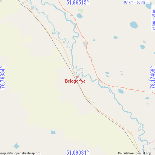
Belogor’ye GPS coordinates[2]
51° 31' 47.388" North, 77° 28' 17.256" East
| Map corner | latitude | longitude |
|---|---|---|
| Upper-left | 51.96515°, | 76.76834° |
| Center: | 51.52983°, | 77.47146° |
| Lower-right: | 51.09031°, | 78.17459° |
| Map W x H: | 97.3×97.3 km | = 60.5×60.5mi |
| max Lat: | 54.90596° ⇑21.5% North |
| Belogor’ye: | 51.52983° |
| min Lat: | ⇓78.5% South 40.66338° |
| min Long | Belogor’ye | max Long |
| 46.83361° | 77.47146° | 84.87144° |
| W 82.2%⇐ | ⇒17.8% E |
Elevation
Elevation of Belogor’ye is 131 m = 430 ft, and this is 225.5 m = 740 ft below average elevation for this country.
| Max E: |
1847 m = 6060 ft | 77.4% |
| Avg. | 356.5 m = 1170 ft | |
| Belogor’ye | 131 m = 430 ft | |
Min E: |
-26 m = -85 ft | 22.6% |
See also: Kazakhstan elevation on elevation.city.
Geographical zone
Belogor’ye is located in North temperate zone (between Tropic of Cancer and the Arctic Circle). Distance of this North polar circle is 1671.6 km =1038.7 mi to North.| Distance of | km | miles | from Belogor’ye |
|---|---|---|---|
| North Pole | 4277.5 | 2657.9 | to North |
| Arctic Circle | 1671.6 | 1038.7 | to North |
| Tropic Cancer | 3123.7 | 1941 | to South |
| Equator | 5729.6 | 3560.2 | to South |


Nearby cities:
15 places around Belogor’ye: (largest is in red/bold)
• Aksu
68 km =42.3 mi,  326°
326°
• Bayanaul
148.1 km =92 mi,  236°
236°
• Borodulikha
257.6 km =160.1 mi,  110°
110°
• Ekibastuz
149.9 km =93.1 mi,  278°
278°
• Irtyshsk
242.6 km =150.7 mi, 325°
• Kalkaman
110 km =68.4 mi,  295°
295°
• Kurchatov
113.9 km =70.8 mi,  139°
139°
• Leninskiy
93.3 km =58 mi, 329°
• Mayqayyng
115.8 km =72 mi,  266°
266°
• Pavlodar
90.7 km =56.4 mi,  337°
337°
• Prigorodnoye
243.8 km =151.5 mi,  213°
213°
• Qarqaraly
274.6 km =170.6 mi, 210°
• Qashyr
194.5 km =120.9 mi, 331°
• Semey
230.9 km =143.5 mi,  122°
122°
• Zhelezinka
266.8 km =165.8 mi, 326°
Sources, notices
• [Note1] Compared only with cities in Kazakhstan existing in our database
• [Src1] Map data: © OpenStreetMap contributors (CC-BY-SA)
• [Src2] Other city data from geonames.org with taken over terms of usage.
• [Src3] Geographical zone / Annual Mean Temperature by Robert A. Rohde @ Wikipedia
