Qazaly geodata
Qazaly (Qyzylorda) is a populated place; located in Kazakhstan in Asia/Qyzylorda (GMT+5) time zone. With population of 7,686 people, there are 148 cities with bigger population in this country. Compared to other cities in Kazakhstan, 68.1% of cities are located further ↑North; 78.5% of cities are located further →East and 87.8% of cities have higher elevation than Qazaly. Note1


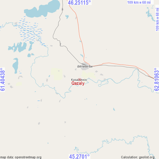
Qazaly GPS coordinates[2]
45° 45' 46.008" North, 62° 6' 27" East
| Map corner | latitude | longitude |
|---|---|---|
| Upper-left | 46.25115°, | 61.40438° |
| Center: | 45.76278°, | 62.1075° |
| Lower-right: | 45.2701°, | 62.81063° |
| Map W x H: | 109.1×109.1 km | = 67.8×67.8mi |
| max Lat: | 54.90596° ⇑68.1% North |
| Qazaly: | 45.76278° |
| min Lat: | ⇓31.9% South 40.66338° |
| min Long | Qazaly | max Long |
| 46.83361° | 62.1075° | 84.87144° |
| W 21.5%⇐ | ⇒78.5% E |
Elevation
Elevation of Qazaly is 68 m = 223 ft, and this is 288.5 m = 947 ft below average elevation for this country.
| Max E: |
1847 m = 6060 ft | 87.8% |
| Avg. | 356.5 m = 1170 ft | |
| Qazaly | 68 m = 223 ft | |
Min E: |
-26 m = -85 ft | 12.2% |
See also: Kazakhstan elevation on elevation.city.
Geographical zone
Qazaly is located in North temperate zone (between Tropic of Cancer and the Arctic Circle). Distance of this North polar circle is 2312.8 km =1437.1 mi to North.| Distance of | km | miles | from Qazaly |
|---|---|---|---|
| North Pole | 4918.7 | 3056.3 | to North |
| Arctic Circle | 2312.8 | 1437.1 | to North |
| Tropic Cancer | 2482.4 | 1542.5 | to South |
| Equator | 5088.3 | 3161.7 | to South |


Nearby cities:
13 places around Qazaly: (largest is in red/bold)
• Aral
120.2 km =74.7 mi,  343°
343°
• Ayteke Bi
9.9 km =6.2 mi,  20°
20°
• Baikonur
95.3 km =59.2 mi,  99°
99°
• Belköl
292.1 km =181.5 mi,  111°
111°
• Dzhalagash
213.5 km =132.7 mi, 110°
• Kyzylorda
284.6 km =176.8 mi, 110°
• Sekseūil
164.7 km =102.3 mi,  333°
333°
• Shalqar
299 km =185.8 mi,  320°
320°
• Tasböget
291.1 km =180.9 mi, 112°
• Terenozek
238.1 km =147.9 mi, 109°
• Tyuratam
94.3 km =58.6 mi, 97°
• Yrghyz
323.6 km =201.1 mi,  348°
348°
• Zhosaly
156.2 km =97.1 mi, 101°
Sources, notices
• [Note1] Compared only with cities in Kazakhstan existing in our database
• [Src1] Map data: © OpenStreetMap contributors (CC-BY-SA)
• [Src2] Other city data from geonames.org with taken over terms of usage.
• [Src3] Geographical zone / Annual Mean Temperature by Robert A. Rohde @ Wikipedia
