Dzhalagash geodata
Dzhalagash (Qyzylorda) is a populated place; located in Kazakhstan in Asia/Qyzylorda (GMT+5) time zone. With population of 14,226 people, there are 81 cities with bigger population in this country. Compared to other cities in Kazakhstan, 72.2% of cities are located further ↑North; 73% of cities are located further →East and 81.1% of cities have higher elevation than Dzhalagash. Note1


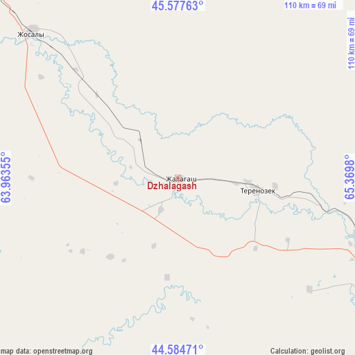
Dzhalagash GPS coordinates[2]
45° 4' 59.988" North, 64° 40' 0.012" East
| Map corner | latitude | longitude |
|---|---|---|
| Upper-left | 45.57763°, | 63.96355° |
| Center: | 45.08333°, | 64.66667° |
| Lower-right: | 44.58471°, | 65.3698° |
| Map W x H: | 110.4×110.4 km | = 68.6×68.6mi |
| max Lat: | 54.90596° ⇑72.2% North |
| Dzhalagash: | 45.08333° |
| min Lat: | ⇓27.8% South 40.66338° |
| min Long | Dzhalagash | max Long |
| 46.83361° | 64.66667° | 84.87144° |
| W 27%⇐ | ⇒73% E |
Elevation
Elevation of Dzhalagash is 111 m = 364 ft, and this is 245.5 m = 805 ft below average elevation for this country.
| Max E: |
1847 m = 6060 ft | 81.1% |
| Avg. | 356.5 m = 1170 ft | |
| Dzhalagash | 111 m = 364 ft | |
Min E: |
-26 m = -85 ft | 18.9% |
See also: Kazakhstan elevation on elevation.city.
Geographical zone
Dzhalagash is located in North temperate zone (between Tropic of Cancer and the Arctic Circle). Distance of this North polar circle is 2388.4 km =1484.1 mi to North.| Distance of | km | miles | from Dzhalagash |
|---|---|---|---|
| North Pole | 4994.3 | 3103.3 | to North |
| Arctic Circle | 2388.4 | 1484.1 | to North |
| Tropic Cancer | 2406.9 | 1495.6 | to South |
| Equator | 5012.8 | 3114.8 | to South |


Nearby cities:
13 places around Dzhalagash: (largest is in red/bold)
• Aral
300.4 km =186.7 mi,  309°
309°
• Ayteke Bi
213.6 km =132.7 mi,  293°
293°
• Baikonur
121 km =75.2 mi,  299°
299°
• Belköl
78.5 km =48.8 mi,  112°
112°
• Kyzylorda
71.1 km =44.2 mi, 111°
• Qazaly
213.5 km =132.7 mi, 290°
• Shalqīya
248 km =154.1 mi,  118°
118°
• Shīeli
192.9 km =119.9 mi, 121°
• Tasböget
77.7 km =48.3 mi, 116°
• Terenozek
25.2 km =15.7 mi,  98°
98°
• Tyuratam
123.2 km =76.6 mi, 300°
• Yanykurgan
242.8 km =150.9 mi, 122°
• Zhosaly
64.4 km =40 mi, 314°
Sources, notices
• [Note1] Compared only with cities in Kazakhstan existing in our database
• [Src1] Map data: © OpenStreetMap contributors (CC-BY-SA)
• [Src2] Other city data from geonames.org with taken over terms of usage.
• [Src3] Geographical zone / Annual Mean Temperature by Robert A. Rohde @ Wikipedia
