Zhosaly geodata
Zhosaly (Qyzylorda) is a populated place; located in Kazakhstan in Asia/Qyzylorda (GMT+5) time zone. With population of 20,065 people, there are 67 cities with bigger population in this country. Compared to other cities in Kazakhstan, 69.3% of cities are located further ↑North; 74.1% of cities are located further →East and 83.7% of cities have higher elevation than Zhosaly. Note1


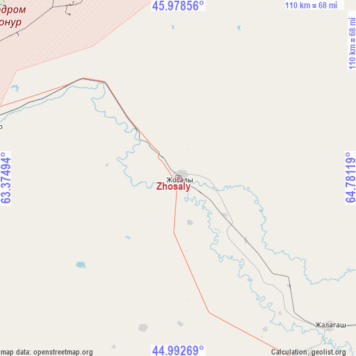
Zhosaly GPS coordinates[2]
45° 29' 16.008" North, 64° 4' 41.016" East
| Map corner | latitude | longitude |
|---|---|---|
| Upper-left | 45.97856°, | 63.37494° |
| Center: | 45.48778°, | 64.07806° |
| Lower-right: | 44.99269°, | 64.78119° |
| Map W x H: | 109.6×109.6 km | = 68.1×68.1mi |
| max Lat: | 54.90596° ⇑69.3% North |
| Zhosaly: | 45.48778° |
| min Lat: | ⇓30.7% South 40.66338° |
| min Long | Zhosaly | max Long |
| 46.83361° | 64.07806° | 84.87144° |
| W 25.9%⇐ | ⇒74.1% E |
Elevation
Elevation of Zhosaly is 100 m = 328 ft, and this is 256.5 m = 842 ft below average elevation for this country.
| Max E: |
1847 m = 6060 ft | 83.7% |
| Avg. | 356.5 m = 1170 ft | |
| Zhosaly | 100 m = 328 ft | |
Min E: |
-26 m = -85 ft | 16.3% |
See also: Kazakhstan elevation on elevation.city.
Geographical zone
Zhosaly is located in North temperate zone (between Tropic of Cancer and the Arctic Circle). Distance of this North polar circle is 2343.4 km =1456.1 mi to North.| Distance of | km | miles | from Zhosaly |
|---|---|---|---|
| North Pole | 4949.3 | 3075.4 | to North |
| Arctic Circle | 2343.4 | 1456.1 | to North |
| Tropic Cancer | 2451.8 | 1523.5 | to South |
| Equator | 5057.8 | 3142.8 | to South |


Nearby cities:
14 places around Zhosaly: (largest is in red/bold)
• Aral
236.2 km =146.8 mi,  308°
308°
• Ayteke Bi
154.8 km =96.2 mi,  284°
284°
• Baikonur
61 km =37.9 mi, 283°
• Belköl
140.3 km =87.2 mi,  122°
122°
• Dzhalagash
64.4 km =40 mi,  134°
134°
• Kyzylorda
132.5 km =82.3 mi, 122°
• Qazaly
156.2 km =97.1 mi, 281°
• Sekseūil
286.8 km =178.2 mi, 308°
• Shalqīya
310.2 km =192.7 mi, 121°
• Shīeli
256 km =159.1 mi, 124°
• Tasböget
140.3 km =87.2 mi, 124°
• Terenozek
86 km =53.4 mi, 124°
• Tyuratam
62.3 km =38.7 mi,  286°
286°
• Yanykurgan
305.9 km =190.1 mi, 125°
Sources, notices
• [Note1] Compared only with cities in Kazakhstan existing in our database
• [Src1] Map data: © OpenStreetMap contributors (CC-BY-SA)
• [Src2] Other city data from geonames.org with taken over terms of usage.
• [Src3] Geographical zone / Annual Mean Temperature by Robert A. Rohde @ Wikipedia
