Yrghyz geodata
Yrghyz (Aqtöbe) is a populated place; located in Kazakhstan in Asia/Aqtobe (GMT+5) time zone. With population of 4,673 people, there are 201 cities with bigger population in this country. Compared to other cities in Kazakhstan, 52.6% of cities are located further ↑North; 80% of cities are located further →East and 83.7% of cities have higher elevation than Yrghyz. Note1


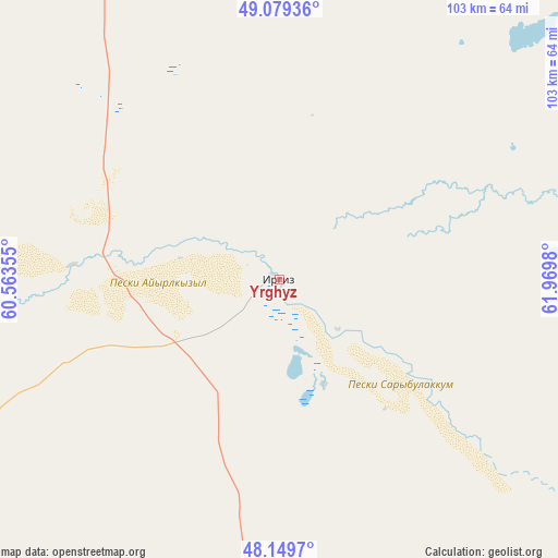
Yrghyz GPS coordinates[2]
48° 37' 0.012" North, 61° 16' 0.012" East
| Map corner | latitude | longitude |
|---|---|---|
| Upper-left | 49.07936°, | 60.56355° |
| Center: | 48.61667°, | 61.26667° |
| Lower-right: | 48.1497°, | 61.9698° |
| Map W x H: | 103.4×103.4 km | = 64.2×64.2mi |
| max Lat: | 54.90596° ⇑52.6% North |
| Yrghyz: | 48.61667° |
| min Lat: | ⇓47.4% South 40.66338° |
| min Long | Yrghyz | max Long |
| 46.83361° | 61.26667° | 84.87144° |
| W 20%⇐ | ⇒80% E |
Elevation
Elevation of Yrghyz is 100 m = 328 ft, and this is 256.5 m = 842 ft below average elevation for this country.
| Max E: |
1847 m = 6060 ft | 83.7% |
| Avg. | 356.5 m = 1170 ft | |
| Yrghyz | 100 m = 328 ft | |
Min E: |
-26 m = -85 ft | 16.3% |
See also: Kazakhstan elevation on elevation.city.
Geographical zone
Yrghyz is located in North temperate zone (between Tropic of Cancer and the Arctic Circle). Distance of this North polar circle is 1995.5 km =1239.9 mi to North.| Distance of | km | miles | from Yrghyz |
|---|---|---|---|
| North Pole | 4601.4 | 2859.2 | to North |
| Arctic Circle | 1995.5 | 1239.9 | to North |
| Tropic Cancer | 2799.7 | 1739.7 | to South |
| Equator | 5405.7 | 3358.9 | to South |


Nearby cities:
14 places around Yrghyz: (largest is in red/bold)
• Aral
204.2 km =126.9 mi,  171°
171°
• Ayteke Bi
315.2 km =195.9 mi, 167°
• Baikonur
367.8 km =228.5 mi,  155°
155°
• Batamshinskiy
305.1 km =189.6 mi,  315°
315°
• Dzhetygara
397.4 km =246.9 mi,  359°
359°
• Embi
229.8 km =142.8 mi,  275°
275°
• Kandyagash
296 km =183.9 mi,  288°
288°
• Khromtau
273.5 km =169.9 mi,  311°
311°
• Ordzhonikidze
427.3 km =265.5 mi,  4°
4°
• Qazaly
323.6 km =201.1 mi, 168°
• Sekseūil
170 km =105.6 mi,  182°
182°
• Shalqar
151.1 km =93.9 mi,  234°
234°
• Torghay
197.9 km =123 mi,  55°
55°
• Tyuratam
364.3 km =226.4 mi,  154°
154°
Sources, notices
• [Note1] Compared only with cities in Kazakhstan existing in our database
• [Src1] Map data: © OpenStreetMap contributors (CC-BY-SA)
• [Src2] Other city data from geonames.org with taken over terms of usage.
• [Src3] Geographical zone / Annual Mean Temperature by Robert A. Rohde @ Wikipedia
