Kyzylorda geodata
Kyzylorda (Qyzylorda) is a seat of a first-order administrative division; located in Kazakhstan in Asia/Qyzylorda (GMT+5) time zone. With population of 300,000 people, there are 7 cities with bigger population in this country. Compared to other cities in Kazakhstan, 74.1% of cities are located further ↑North; 71.9% of cities are located further →East and 79.3% of cities have higher elevation than Kyzylorda. Note1


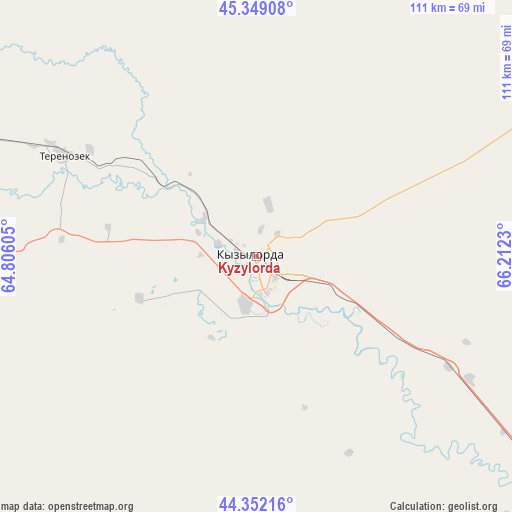
Kyzylorda GPS coordinates[2]
44° 51' 10.008" North, 65° 30' 33.012" East
| Map corner | latitude | longitude |
|---|---|---|
| Upper-left | 45.34908°, | 64.80605° |
| Center: | 44.85278°, | 65.50917° |
| Lower-right: | 44.35216°, | 66.2123° |
| Map W x H: | 110.8×110.8 km | = 68.8×68.8mi |
| max Lat: | 54.90596° ⇑74.1% North |
| Kyzylorda: | 44.85278° |
| min Lat: | ⇓25.9% South 40.66338° |
| min Long | Kyzylorda | max Long |
| 46.83361° | 65.50917° | 84.87144° |
| W 28.1%⇐ | ⇒71.9% E |
Elevation
Elevation of Kyzylorda is 128 m = 420 ft, and this is 228.5 m = 750 ft below average elevation for this country.
| Max E: |
1847 m = 6060 ft | 79.3% |
| Avg. | 356.5 m = 1170 ft | |
| Kyzylorda | 128 m = 420 ft | |
Min E: |
-26 m = -85 ft | 20.7% |
See also: Kyzylorda elevation on elevation.city.
Geographical zone
Kyzylorda is located in North temperate zone (between Tropic of Cancer and the Arctic Circle). Distance of this Northern Tropic circle is 2381.2 km =1479.6 mi to South.| Distance of | km | miles | from Kyzylorda |
|---|---|---|---|
| North Pole | 5019.9 | 3119.2 | to North |
| Arctic Circle | 2414 | 1500 | to North |
| Tropic Cancer | 2381.2 | 1479.6 | to South |
| Equator | 4987.2 | 3098.9 | to South |


Nearby cities:
15 places around Kyzylorda: (largest is in red/bold)
• Ayteke Bi
284.6 km =176.8 mi,  292°
292°
• Baikonur
191.5 km =119 mi,  296°
296°
• Belköl
7.7 km =4.8 mi,  126°
126°
• Dzhalagash
71.1 km =44.2 mi, 291°
• Kantagi
285.9 km =177.7 mi,  121°
121°
• Kentau
281.2 km =174.7 mi, 121°
• Qazaly
284.6 km =176.8 mi, 290°
• Shalqīya
177.7 km =110.4 mi, 121°
• Shīeli
123.7 km =76.9 mi, 127°
• Tasböget
9.4 km =5.8 mi,  158°
158°
• Terenozek
46.8 km =29.1 mi, 298°
• Turkestan
279.1 km =173.4 mi, 128°
• Tyuratam
193.5 km =120.2 mi, 297°
• Yanykurgan
173.6 km =107.9 mi, 127°
• Zhosaly
132.5 km =82.3 mi, 302°
In other languages:
- In German: Qysylorda
- In Italian: Qyzylorda
- In Russian: Кызылорда, Кзыл-Орда, Ак-Мечеть, Перовск, Форт Перовский
- In Chinese: 克孜勒奧爾達
Sources, notices
• [Note1] Compared only with cities in Kazakhstan existing in our database
• [Src1] Map data: © OpenStreetMap contributors (CC-BY-SA)
• [Src2] Other city data from geonames.org with taken over terms of usage.
• [Src3] Geographical zone / Annual Mean Temperature by Robert A. Rohde @ Wikipedia
