Belköl geodata
Belköl (Qyzylorda) is a populated place; located in Kazakhstan in Asia/Qyzylorda (GMT+5) time zone. With population of 1,486 people, there are 254 cities with bigger population in this country. Compared to other cities in Kazakhstan, 75.2% of cities are located further ↑North; 71.1% of cities are located further →East and 79.3% of cities have higher elevation than Belköl. Note1


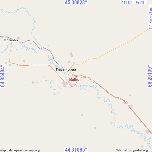
Belköl GPS coordinates[2]
44° 48' 41.832" North, 65° 35' 16.656" East
| Map corner | latitude | longitude |
|---|---|---|
| Upper-left | 45.30828°, | 64.88484° |
| Center: | 44.81162°, | 65.58796° |
| Lower-right: | 44.31065°, | 66.29109° |
| Map W x H: | 110.9×110.9 km | = 68.9×68.9mi |
| max Lat: | 54.90596° ⇑75.2% North |
| Belköl: | 44.81162° |
| min Lat: | ⇓24.8% South 40.66338° |
| min Long | Belköl | max Long |
| 46.83361° | 65.58796° | 84.87144° |
| W 28.9%⇐ | ⇒71.1% E |
Elevation
Elevation of Belköl is 128 m = 420 ft, and this is 228.5 m = 750 ft below average elevation for this country.
| Max E: |
1847 m = 6060 ft | 79.3% |
| Avg. | 356.5 m = 1170 ft | |
| Belköl | 128 m = 420 ft | |
Min E: |
-26 m = -85 ft | 20.7% |
See also: Kazakhstan elevation on elevation.city.
Geographical zone
Belköl is located in North temperate zone (between Tropic of Cancer and the Arctic Circle). Distance of this Northern Tropic circle is 2376.7 km =1476.8 mi to South.| Distance of | km | miles | from Belköl |
|---|---|---|---|
| North Pole | 5024.5 | 3122.1 | to North |
| Arctic Circle | 2418.6 | 1502.8 | to North |
| Tropic Cancer | 2376.7 | 1476.8 | to South |
| Equator | 4982.6 | 3096 | to South |


Nearby cities:
15 places around Belköl: (largest is in red/bold)
• Ayteke Bi
292.1 km =181.5 mi,  293°
293°
• Baikonur
199.1 km =123.7 mi,  296°
296°
• Dzhalagash
78.5 km =48.8 mi, 292°
• Kantagi
278.2 km =172.9 mi,  120°
120°
• Kentau
273.6 km =170 mi, 121°
• Kyzylorda
7.7 km =4.8 mi,  306°
306°
• Qazaly
292.1 km =181.5 mi, 291°
• Shalqīya
170 km =105.6 mi, 121°
• Shīeli
115.9 km =72 mi,  128°
128°
• Tasböget
5.1 km =3.2 mi,  213°
213°
• Terenozek
54.5 km =33.9 mi, 299°
• Turkestan
271.4 km =168.6 mi, 128°
• Tyuratam
201.1 km =125 mi, 297°
• Yanykurgan
165.9 km =103.1 mi, 127°
• Zhosaly
140.3 km =87.2 mi, 302°
Sources, notices
• [Note1] Compared only with cities in Kazakhstan existing in our database
• [Src1] Map data: © OpenStreetMap contributors (CC-BY-SA)
• [Src2] Other city data from geonames.org with taken over terms of usage.
• [Src3] Geographical zone / Annual Mean Temperature by Robert A. Rohde @ Wikipedia
