Terenozek geodata
Terenozek (Qyzylorda) is a populated place; located in Kazakhstan in Asia/Qyzylorda (GMT+5) time zone. With population of 9,661 people, there are 122 cities with bigger population in this country. Compared to other cities in Kazakhstan, 72.6% of cities are located further ↑North; 72.6% of cities are located further →East and 80.4% of cities have higher elevation than Terenozek. Note1


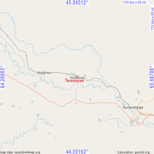
Terenozek GPS coordinates[2]
45° 3' 1.908" North, 64° 59' 2.22" East
| Map corner | latitude | longitude |
|---|---|---|
| Upper-left | 45.54512°, | 64.28083° |
| Center: | 45.05053°, | 64.98395° |
| Lower-right: | 44.55163°, | 65.68708° |
| Map W x H: | 110.5×110.5 km | = 68.7×68.7mi |
| max Lat: | 54.90596° ⇑72.6% North |
| Terenozek: | 45.05053° |
| min Lat: | ⇓27.4% South 40.66338° |
| min Long | Terenozek | max Long |
| 46.83361° | 64.98395° | 84.87144° |
| W 27.4%⇐ | ⇒72.6% E |
Elevation
Elevation of Terenozek is 119 m = 390 ft, and this is 237.5 m = 779 ft below average elevation for this country.
| Max E: |
1847 m = 6060 ft | 80.4% |
| Avg. | 356.5 m = 1170 ft | |
| Terenozek | 119 m = 390 ft | |
Min E: |
-26 m = -85 ft | 19.6% |
See also: Kazakhstan elevation on elevation.city.
Geographical zone
Terenozek is located in North temperate zone (between Tropic of Cancer and the Arctic Circle). Distance of this North polar circle is 2392 km =1486.3 mi to North.| Distance of | km | miles | from Terenozek |
|---|---|---|---|
| North Pole | 4997.9 | 3105.6 | to North |
| Arctic Circle | 2392 | 1486.3 | to North |
| Tropic Cancer | 2403.2 | 1493.3 | to South |
| Equator | 5009.1 | 3112.5 | to South |


Nearby cities:
15 places around Terenozek: (largest is in red/bold)
• Aral
321.9 km =200 mi,  307°
307°
• Ayteke Bi
237.9 km =147.8 mi,  291°
291°
• Baikonur
144.7 km =89.9 mi,  295°
295°
• Belköl
54.5 km =33.9 mi,  119°
119°
• Dzhalagash
25.2 km =15.7 mi,  278°
278°
• Kentau
328 km =203.8 mi, 121°
• Kyzylorda
46.8 km =29.1 mi, 118°
• Qazaly
238.1 km =147.9 mi, 289°
• Shalqīya
224.5 km =139.5 mi, 121°
• Shīeli
170 km =105.6 mi,  125°
125°
• Tasböget
54.3 km =33.7 mi, 124°
• Turkestan
325.4 km =202.2 mi, 126°
• Tyuratam
146.7 km =91.2 mi, 297°
• Yanykurgan
220 km =136.7 mi, 125°
• Zhosaly
86 km =53.4 mi, 304°
Sources, notices
• [Note1] Compared only with cities in Kazakhstan existing in our database
• [Src1] Map data: © OpenStreetMap contributors (CC-BY-SA)
• [Src2] Other city data from geonames.org with taken over terms of usage.
• [Src3] Geographical zone / Annual Mean Temperature by Robert A. Rohde @ Wikipedia
