Shalqīya geodata
Shalqīya (Qyzylorda) is a populated place; located in Kazakhstan in Asia/Qyzylorda (GMT+5) time zone. With population of 3,822 people, there are 215 cities with bigger population in this country. Compared to other cities in Kazakhstan, 80% of cities are located further ↑North; 66.3% of cities are located further →East and 59.6% of cities have higher elevation than Shalqīya. Note1


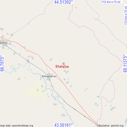
Shalqīya GPS coordinates[2]
44° 0' 34.092" North, 67° 24' 38.232" East
| Map corner | latitude | longitude |
|---|---|---|
| Upper-left | 44.51302°, | 66.7075° |
| Center: | 44.00947°, | 67.41062° |
| Lower-right: | 43.50161°, | 68.11375° |
| Map W x H: | 112.5×112.5 km | = 69.9×69.9mi |
| max Lat: | 54.90596° ⇑80% North |
| Shalqīya: | 44.00947° |
| min Lat: | ⇓20% South 40.66338° |
| min Long | Shalqīya | max Long |
| 46.83361° | 67.41062° | 84.87144° |
| W 33.7%⇐ | ⇒66.3% E |
Elevation
Elevation of Shalqīya is 235 m = 771 ft, and this is 121.5 m = 399 ft below average elevation for this country.
| Max E: |
1847 m = 6060 ft | 59.6% |
| Avg. | 356.5 m = 1170 ft | |
| Shalqīya | 235 m = 771 ft | |
Min E: |
-26 m = -85 ft | 40.4% |
See also: Kazakhstan elevation on elevation.city.
Geographical zone
Shalqīya is located in North temperate zone (between Tropic of Cancer and the Arctic Circle). Distance of this Northern Tropic circle is 2287.5 km =1421.4 mi to South.| Distance of | km | miles | from Shalqīya |
|---|---|---|---|
| North Pole | 5113.7 | 3177.5 | to North |
| Arctic Circle | 2507.8 | 1558.3 | to North |
| Tropic Cancer | 2287.5 | 1421.4 | to South |
| Equator | 4893.4 | 3040.6 | to South |


Nearby cities:
15 places around Shalqīya: (largest is in red/bold)
• Arys
209 km =129.9 mi,  147°
147°
• Ashchysay
129.7 km =80.6 mi,  112°
112°
• Belköl
170 km =105.6 mi,  301°
301°
• Chayan
192.3 km =119.5 mi,  124°
124°
• Chulakkurgan
144.3 km =89.7 mi,  100°
100°
• Kantagi
108.3 km =67.3 mi, 119°
• Kentau
103.5 km =64.3 mi, 121°
• Kyzylorda
177.7 km =110.4 mi, 301°
• Qogham
149 km =92.6 mi, 151°
• Shīeli
56.5 km =35.1 mi,  288°
288°
• Tasböget
170.4 km =105.9 mi, 299°
• Temirlanovka
216.6 km =134.6 mi,  136°
136°
• Turkestan
104.2 km =64.7 mi, 139°
• Yanykurgan
17.4 km =10.8 mi,  228°
228°
• Zhangatas
193 km =119.9 mi, 104°
Sources, notices
• [Note1] Compared only with cities in Kazakhstan existing in our database
• [Src1] Map data: © OpenStreetMap contributors (CC-BY-SA)
• [Src2] Other city data from geonames.org with taken over terms of usage.
• [Src3] Geographical zone / Annual Mean Temperature by Robert A. Rohde @ Wikipedia
