Yanykurgan geodata
Yanykurgan (Qyzylorda) is a populated place; located in Kazakhstan in Asia/Qyzylorda (GMT+5) time zone. With population of 21,339 people, there are 62 cities with bigger population in this country. Compared to other cities in Kazakhstan, 80.4% of cities are located further ↑North; 67.4% of cities are located further →East and 72.6% of cities have higher elevation than Yanykurgan. Note1


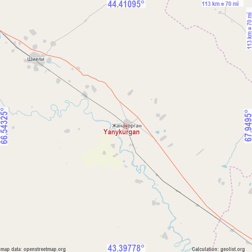
Yanykurgan GPS coordinates[2]
43° 54' 23.472" North, 67° 14' 46.932" East
| Map corner | latitude | longitude |
|---|---|---|
| Upper-left | 44.41095°, | 66.54325° |
| Center: | 43.90652°, | 67.24637° |
| Lower-right: | 43.39778°, | 67.9495° |
| Map W x H: | 112.7×112.7 km | = 70×70mi |
| max Lat: | 54.90596° ⇑80.4% North |
| Yanykurgan: | 43.90652° |
| min Lat: | ⇓19.6% South 40.66338° |
| min Long | Yanykurgan | max Long |
| 46.83361° | 67.24637° | 84.87144° |
| W 32.6%⇐ | ⇒67.4% E |
Elevation
Elevation of Yanykurgan is 166 m = 545 ft, and this is 190.5 m = 625 ft below average elevation for this country.
| Max E: |
1847 m = 6060 ft | 72.6% |
| Avg. | 356.5 m = 1170 ft | |
| Yanykurgan | 166 m = 545 ft | |
Min E: |
-26 m = -85 ft | 27.4% |
See also: Kazakhstan elevation on elevation.city.
Geographical zone
Yanykurgan is located in North temperate zone (between Tropic of Cancer and the Arctic Circle). Distance of this Northern Tropic circle is 2276 km =1414.2 mi to South.| Distance of | km | miles | from Yanykurgan |
|---|---|---|---|
| North Pole | 5125.1 | 3184.6 | to North |
| Arctic Circle | 2519.2 | 1565.4 | to North |
| Tropic Cancer | 2276 | 1414.2 | to South |
| Equator | 4881.9 | 3033.5 | to South |


Nearby cities:
15 places around Yanykurgan: (largest is in red/bold)
• Arys
207.4 km =128.9 mi,  142°
142°
• Ashchysay
138.4 km =86 mi,  106°
106°
• Belköl
165.9 km =103.1 mi,  307°
307°
• Chayan
197.6 km =122.8 mi,  119°
119°
• Chulakkurgan
155.8 km =96.8 mi,  95°
95°
• Kantagi
115.4 km =71.7 mi, 111°
• Kentau
110 km =68.4 mi, 113°
• Kyzylorda
173.6 km =107.9 mi, 307°
• Qogham
146.2 km =90.8 mi,  145°
145°
• Shalqīya
17.4 km =10.8 mi,  48°
48°
• Shīeli
50 km =31.1 mi, 305°
• Tasböget
165.7 km =103 mi, 305°
• Temirlanovka
218.3 km =135.6 mi,  131°
131°
• Turkestan
105.6 km =65.6 mi, 129°
• Zhangatas
203.5 km =126.4 mi, 100°
Sources, notices
• [Note1] Compared only with cities in Kazakhstan existing in our database
• [Src1] Map data: © OpenStreetMap contributors (CC-BY-SA)
• [Src2] Other city data from geonames.org with taken over terms of usage.
• [Src3] Geographical zone / Annual Mean Temperature by Robert A. Rohde @ Wikipedia
