Aqtoghay geodata
Aqtoghay (East Kazakhstan) is a populated place; located in Kazakhstan in Asia/Almaty (GMT+5) time zone. With population of 4,974 people, there are 193 cities with bigger population in this country. Compared to other cities in Kazakhstan, 63% of cities are located further ↑North; 87.4% of cities are located further ←West and 55.2% of cities have lower elevation than Aqtoghay. Note1


Aqtoghay GPS coordinates[2]
46° 57' 0" North, 79° 40' 0.012" East
| Map corner | latitude | longitude |
|---|---|---|
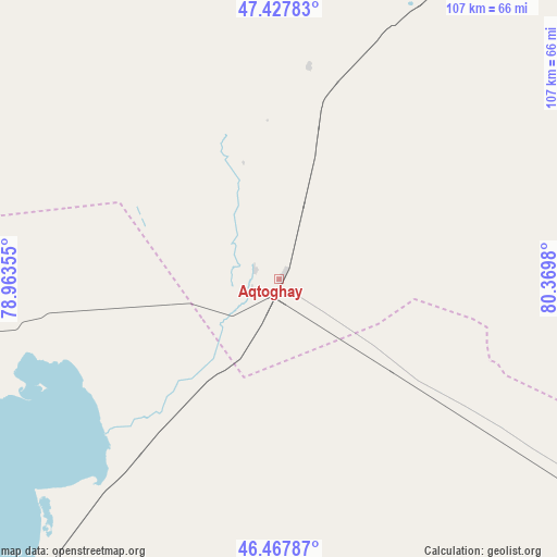
| Upper-left | 47.42783°, | 78.96355° |
| Center: | 46.95°, | 79.66667° |
| Lower-right: | 46.46787°, | 80.3698° |
| Map W x H: | 106.7×106.7 km | = 66.3×66.3mi |
| max Lat: | 54.90596° ⇑63% North |
| Aqtoghay: | 46.95° |
| min Lat: | ⇓37% South 40.66338° |
| min Long | Aqtoghay | max Long |
| 46.83361° | 79.66667° | 84.87144° |
| W 87.4%⇐ | ⇒12.6% E |
Elevation
Elevation of Aqtoghay is 365 m = 1198 ft, and this is 8.5 m = 28 ft above average elevation for this country.
| Max E: |
1847 m = 6060 ft | 44.8% |
| Aqtoghay | 365 m 1198 ft | |
| Avg. | 356.5 m = 1170 ft | |
Min E: |
-26 m = -85 ft | 55.2% |
See also: Kazakhstan elevation on elevation.city.
Geographical zone
Aqtoghay is located in North temperate zone (between Tropic of Cancer and the Arctic Circle). Distance of this North polar circle is 2180.8 km =1355.1 mi to North.| Distance of | km | miles | from Aqtoghay |
|---|---|---|---|
| North Pole | 4786.7 | 2974.3 | to North |
| Arctic Circle | 2180.8 | 1355.1 | to North |
| Tropic Cancer | 2614.4 | 1624.5 | to South |
| Equator | 5220.4 | 3243.8 | to South |


Nearby cities:
15 places around Aqtoghay: (largest is in red/bold)
• Ayagoz
126.7 km =78.7 mi,  27°
27°
• Balpyk Bī
253.3 km =157.4 mi,  205°
205°
• Karabas
268.2 km =166.7 mi,  260°
260°
• Lepsy
96.7 km =60.1 mi, 214°
• Matay
138 km =85.7 mi, 211°
• Molaly
196.3 km =122 mi, 212°
• Qaraūyl
223.9 km =139.1 mi,  352°
352°
• Sarkand
172.2 km =107 mi,  173°
173°
• Sarykamys
117.1 km =72.8 mi,  322°
322°
• Sayaq
182.2 km =113.2 mi,  271°
271°
• Taldykorgan
237.1 km =147.3 mi,  204°
204°
• Tekeli
244.1 km =151.7 mi, 195°
• Urzhar
149.6 km =93 mi,  83°
83°
• Ush-Tyube
229.2 km =142.4 mi, 214°
• Zhalghyztobe
276.5 km =171.8 mi,  24°
24°
Sources, notices
• [Note1] Compared only with cities in Kazakhstan existing in our database
• [Src1] Map data: © OpenStreetMap contributors (CC-BY-SA)
• [Src2] Other city data from geonames.org with taken over terms of usage.
• [Src3] Geographical zone / Annual Mean Temperature by Robert A. Rohde @ Wikipedia
