Gampola geodata
Gampola (Central) is a populated place; located in Sri Lanka in Asia/Colombo (GMT+5.5) time zone. With population of 24,730 people, there are 43 cities with bigger population in this country. Compared to other cities in Sri Lanka, 63.2% of cities are located further ↓South; 68.4% of cities are located further ←West and 89.5% of cities have lower elevation than Gampola. Note1
Administrative division(s):
- Level 1: Central
- Level 2: Kandy District
- Level 3: Uda Palata Division
- Level 4: Polkumbura


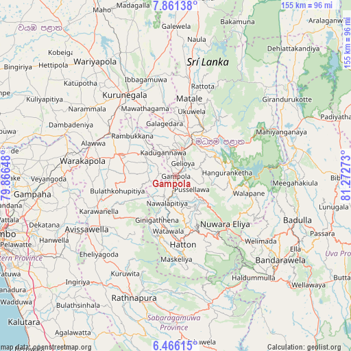
Gampola GPS coordinates[2]
7° 9' 51.48" North, 80° 34' 10.56" East
| Map corner | latitude | longitude |
|---|---|---|
| Upper-left | 7.86138°, | 79.86648° |
| Center: | 7.1643°, | 80.5696° |
| Lower-right: | 6.46615°, | 81.27273° |
| Map W x H: | 155.1×155.1 km | = 96.4×96.4mi |
| max Lat: | 9.81667° ⇑36.8% North |
| Gampola: | 7.1643° |
| min Lat: | ⇓63.2% South 5.92825° |
| min Long | Gampola | max Long |
| 79.79528° | 80.5696° | 81.83472° |
| W 68.4%⇐ | ⇒31.6% E |
Elevation
Elevation of Gampola is 492 m = 1614 ft, and this is 334.6 m = 1098 ft above average elevation for this country.
| Max E: |
1868 m = 6129 ft | 10.5% |
| Gampola | 492 m 1614 ft | |
| Avg. | 157.4 m = 516 ft | |
Min E: |
1 m = 3 ft | 89.5% |
See also: Sri Lanka elevation on elevation.city.
Geographical zone
Gampola is located in North Torrid zone (between Equator and Tropic of Cancer). Distance of Equator is 796.6 km =495 mi to South.| Distance of | km | miles | from Gampola |
|---|---|---|---|
| North Pole | 9210.5 | 5723.1 | to North |
| Arctic Circle | 6604.6 | 4103.9 | to North |
| Tropic Cancer | 1809.3 | 1124.2 | to North |
| Equator | 796.6 | 495 | to South |


Nearby cities:
15 places around Gampola: (largest is in red/bold)
• Badulla
57.6 km =35.8 mi,  110°
110°
• Ella Town
61.6 km =38.3 mi,  121°
121°
• Gampaha
64.2 km =39.9 mi,  262°
262°
• Hanwella Ihala
60.9 km =37.8 mi,  241°
241°
• Haputale
61.1 km =38 mi,  136°
136°
• Hatton
30.5 km =19 mi,  174°
174°
• Kadugannawa
11.2 km =7 mi,  333°
333°
• Kandy
15.7 km =9.8 mi,  26°
26°
• Kegalle
26.8 km =16.7 mi,  291°
291°
• Kuliyapitiya
67.5 km =41.9 mi,  300°
300°
• Kurunegala
41.9 km =26 mi, 328°
• Matale
34.5 km =21.4 mi,  9°
9°
• Nuwara Eliya
31.9 km =19.8 mi,  132°
132°
• Ratnapura
56.3 km =35 mi,  199°
199°
• Talawakele
27.1 km =16.8 mi,  158°
158°
Sources, notices
• [Note1] Compared only with cities in Sri Lanka existing in our database
• [Src1] Map data: © OpenStreetMap contributors (CC-BY-SA)
• [Src2] Other city data from geonames.org with taken over terms of usage.
• [Src3] Geographical zone / Annual Mean Temperature by Robert A. Rohde @ Wikipedia
