Ganta geodata
Ganta (Nimba) is a populated place; located in Liberia in Africa/Monrovia (GMT+0) time zone. With population of 13,802 people, there are 10 cities with bigger population in this country. Compared to other cities in Liberia, 83.3% of cities are located further ↓South; 72.2% of cities are located further ←West and 83.3% of cities have lower elevation than Ganta. Note1


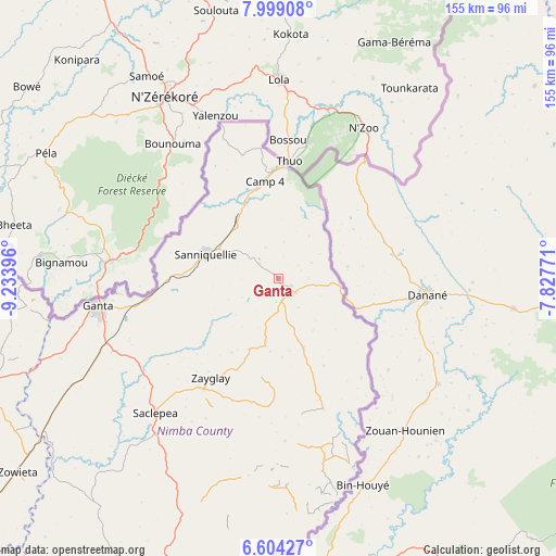
Ganta GPS coordinates[2]
7° 18' 7.992" North, 8° 31' 50.988" West
| Map corner | latitude | longitude |
|---|---|---|
| Upper-left | 7.99908°, | -9.23396° |
| Center: | 7.30222°, | -8.53083° |
| Lower-right: | 6.60427°, | -7.82771° |
| Map W x H: | 155.1×155.1 km | = 96.4×96.4mi |
| max Lat: | 8.42194° ⇑16.7% North |
| Ganta: | 7.30222° |
| min Lat: | ⇓83.3% South 4.3782° |
| min Long | Ganta | max Long |
| -11.3671° | -8.53083° | -7.71081° |
| W 72.2%⇐ | ⇒27.8% E |
Elevation
Elevation of Ganta is 408 m = 1339 ft, and this is 228.9 m = 751 ft above average elevation for this country.
| Max E: |
550 m = 1804 ft | 16.7% |
| Ganta | 408 m 1339 ft | |
| Avg. | 179.1 m = 588 ft | |
Min E: |
5 m = 16 ft | 83.3% |
See also: Liberia elevation on elevation.city.
Geographical zone
Ganta is located in North Torrid zone (between Equator and Tropic of Cancer). Distance of Equator is 811.9 km =504.5 mi to South.| Distance of | km | miles | from Ganta |
|---|---|---|---|
| North Pole | 9195.1 | 5713.6 | to North |
| Arctic Circle | 6589.2 | 4094.3 | to North |
| Tropic Cancer | 1794 | 1114.7 | to North |
| Equator | 811.9 | 504.5 | to South |


Nearby cities:
15 places around Ganta: (largest is in red/bold)
• Bensonville
248.7 km =154.5 mi,  247°
247°
• Bopolu
217.4 km =135.1 mi,  263°
263°
• Buchanan
230.8 km =143.4 mi,  226°
226°
• Buutuo
56.7 km =35.2 mi,  158°
158°
• Cestos City
235.8 km =146.5 mi,  209°
209°
• Fish Town
245 km =152.2 mi, 162°
• Gbarnga
109.2 km =67.9 mi, 251°
• Greenville
260.8 km =162.1 mi,  192°
192°
• Kakata
218.7 km =135.9 mi, 246°
• Monrovia
273.9 km =170.2 mi, 246°
• New Yekepa
30.8 km =19.1 mi,  358°
358°
• Sanniquellie
21.2 km =13.2 mi,  288°
288°
• Tubmanburg
257.2 km =159.8 mi, 259°
• Voinjama
182.9 km =113.6 mi,  312°
312°
• Zwedru
144 km =89.5 mi, 162°
Sources, notices
• [Note1] Compared only with cities in Liberia existing in our database
• [Src1] Map data: © OpenStreetMap contributors (CC-BY-SA)
• [Src2] Other city data from geonames.org with taken over terms of usage.
• [Src3] Geographical zone / Annual Mean Temperature by Robert A. Rohde @ Wikipedia
