Bopolu geodata
Bopolu (Gbarpolu) is a seat of a first-order administrative division; located in Liberia in Africa/Monrovia (GMT+0) time zone. With population of 2,908 people, there are 15 cities with bigger population in this country. Compared to other cities in Liberia, 77.8% of cities are located further ↓South; 77.8% of cities are located further →East and 55.6% of cities have lower elevation than Bopolu. Note1


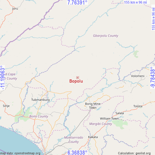
Bopolu GPS coordinates[2]
7° 4' 0.012" North, 10° 29' 15" West
| Map corner | latitude | longitude |
|---|---|---|
| Upper-left | 7.76391°, | -11.19063° |
| Center: | 7.06667°, | -10.4875° |
| Lower-right: | 6.36838°, | -9.78438° |
| Map W x H: | 155.2×155.2 km | = 96.4×96.4mi |
| max Lat: | 8.42194° ⇑22.2% North |
| Bopolu: | 7.06667° |
| min Lat: | ⇓77.8% South 4.3782° |
| min Long | Bopolu | max Long |
| -11.3671° | -10.4875° | -7.71081° |
| W 22.2%⇐ | ⇒77.8% E |
Elevation
Elevation of Bopolu is 179 m = 587 ft, and this is 0.099999999999994 m = 0 ft below average elevation for this country.
| Max E: |
550 m = 1804 ft | 44.4% |
| Avg. | 179.1 m = 588 ft | |
| Bopolu | 179 m = 587 ft | |
Min E: |
5 m = 16 ft | 55.6% |
See also: Liberia elevation on elevation.city.
Geographical zone
Bopolu is located in North Torrid zone (between Equator and Tropic of Cancer). Distance of Equator is 785.7 km =488.2 mi to South.| Distance of | km | miles | from Bopolu |
|---|---|---|---|
| North Pole | 9221.3 | 5729.8 | to North |
| Arctic Circle | 6615.4 | 4110.6 | to North |
| Tropic Cancer | 1820.2 | 1131 | to North |
| Equator | 785.7 | 488.2 | to South |


Nearby cities:
15 places around Bopolu: (largest is in red/bold)
• Bensonville
70.3 km =43.7 mi,  191°
191°
• Buchanan
140.9 km =87.6 mi,  159°
159°
• Buutuo
238.2 km =148 mi,  96°
96°
• Cestos City
205.1 km =127.4 mi,  150°
150°
• Ganta
217.4 km =135.1 mi,  83°
83°
• Gbarnga
112.4 km =69.8 mi,  94°
94°
• Greenville
279.1 km =173.4 mi,  144°
144°
• Kakata
61.4 km =38.2 mi,  166°
166°
• Monrovia
91.8 km =57 mi,  201°
201°
• New Yekepa
222.4 km =138.2 mi, 75°
• Robertsport
103.2 km =64.1 mi,  250°
250°
• Sanniquellie
198.5 km =123.3 mi, 80°
• Tubmanburg
42.8 km =26.6 mi,  239°
239°
• Voinjama
171.3 km =106.4 mi,  28°
28°
• Zwedru
282.5 km =175.5 mi,  113°
113°
Sources, notices
• [Note1] Compared only with cities in Liberia existing in our database
• [Src1] Map data: © OpenStreetMap contributors (CC-BY-SA)
• [Src2] Other city data from geonames.org with taken over terms of usage.
• [Src3] Geographical zone / Annual Mean Temperature by Robert A. Rohde @ Wikipedia
