Ingettolgoy geodata
Ingettolgoy (Bulgan) is a seat of a second-order administrative division; located in Mongolia in Asia/Ulaanbaatar (GMT+8) time zone. In our database, there are 33 cities with bigger population. Compared to other cities in Mongolia, 86.2% of cities are located further ↓South; 57.7% of cities are located further ←West and 92.3% of cities have higher elevation than Ingettolgoy. Note1


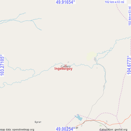
Ingettolgoy GPS coordinates[2]
49° 27' 42.012" North, 103° 58' 27.012" East
| Map corner | latitude | longitude |
|---|---|---|
| Upper-left | 49.91654°, | 103.27105° |
| Center: | 49.46167°, | 103.97417° |
| Lower-right: | 49.00254°, | 104.6773° |
| Map W x H: | 101.6×101.6 km | = 63.1×63.1mi |
| max Lat: | 51.50725° ⇑13.8% North |
| Ingettolgoy: | 49.46167° |
| min Lat: | ⇓86.2% South 42.84199° |
| min Long | Ingettolgoy | max Long |
| 89.14358° | 103.97417° | 118.51014° |
| W 57.7%⇐ | ⇒42.3% E |
Elevation
Elevation of Ingettolgoy is 796 m = 2612 ft, and this is 620.5 m = 2036 ft below average elevation for this country.
| Max E: |
2800 m = 9186 ft | 92.3% |
| Avg. | 1416.5 m = 4647 ft | |
| Ingettolgoy | 796 m = 2612 ft | |
Min E: |
619 m = 2031 ft | 7.7% |
See also: Mongolia elevation on elevation.city.
Geographical zone
Ingettolgoy is located in North temperate zone (between Tropic of Cancer and the Arctic Circle). Distance of this North polar circle is 1901.6 km =1181.6 mi to North.| Distance of | km | miles | from Ingettolgoy |
|---|---|---|---|
| North Pole | 4507.4 | 2800.8 | to North |
| Arctic Circle | 1901.6 | 1181.6 | to North |
| Tropic Cancer | 2893.7 | 1798.1 | to South |
| Equator | 5499.6 | 3417.3 | to South |


Nearby cities:
15 places around Ingettolgoy: (largest is in red/bold)
• Bugat
49.3 km =30.6 mi,  206°
206°
• Bulgan
78.9 km =49 mi,  203°
203°
• Burgaltay
59.8 km =37.2 mi,  111°
111°
• Dzelter
122.1 km =75.9 mi,  38°
38°
• Enhtal
104.1 km =64.7 mi,  103°
103°
• Erdenet
48.3 km =30 mi,  170°
170°
• Hushaat
118.7 km =73.8 mi,  87°
87°
• Hutag
92.9 km =57.7 mi,  265°
265°
• Huurch
126 km =78.3 mi,  55°
55°
• Jargalant
48.5 km =30.1 mi,  139°
139°
• Mandal
97.9 km =60.8 mi, 199°
• Nart
108.4 km =67.4 mi, 108°
• Orhontuul
92.4 km =57.4 mi,  128°
128°
• Sört
33.6 km =20.9 mi,  118°
118°
• Teshig
108.7 km =67.5 mi,  299°
299°
Sources, notices
• [Note1] Compared only with cities in Mongolia existing in our database
• [Src1] Map data: © OpenStreetMap contributors (CC-BY-SA)
• [Src2] Other city data from geonames.org with taken over terms of usage.
• [Src3] Geographical zone / Annual Mean Temperature by Robert A. Rohde @ Wikipedia
