Hongor geodata
Hongor (Sühbaatar) is a seat of a second-order administrative division; located in Mongolia in Asia/Choibalsan (GMT+8) time zone. In our database, there are 33 cities with bigger population. Compared to other cities in Mongolia, 90.2% of cities are located further ↑North; 96% of cities are located further ←West and 63.5% of cities have higher elevation than Hongor. Note1


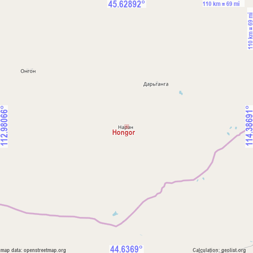
Hongor GPS coordinates[2]
45° 8' 6.252" North, 113° 41' 1.608" East
| Map corner | latitude | longitude |
|---|---|---|
| Upper-left | 45.62892°, | 112.98066° |
| Center: | 45.13507°, | 113.68378° |
| Lower-right: | 44.6369°, | 114.38691° |
| Map W x H: | 110.3×110.3 km | = 68.5×68.5mi |
| max Lat: | 51.50725° ⇑90.2% North |
| Hongor: | 45.13507° |
| min Lat: | ⇓9.8% South 42.84199° |
| min Long | Hongor | max Long |
| 89.14358° | 113.68378° | 118.51014° |
| W 96%⇐ | ⇒4% E |
Elevation
Elevation of Hongor is 1247 m = 4091 ft, and this is 169.5 m = 556 ft below average elevation for this country.
| Max E: |
2800 m = 9186 ft | 63.5% |
| Avg. | 1416.5 m = 4647 ft | |
| Hongor | 1247 m = 4091 ft | |
Min E: |
619 m = 2031 ft | 36.5% |
See also: Mongolia elevation on elevation.city.
Geographical zone
Hongor is located in North temperate zone (between Tropic of Cancer and the Arctic Circle). Distance of this North polar circle is 2382.6 km =1480.5 mi to North.| Distance of | km | miles | from Hongor |
|---|---|---|---|
| North Pole | 4988.5 | 3099.7 | to North |
| Arctic Circle | 2382.6 | 1480.5 | to North |
| Tropic Cancer | 2412.6 | 1499.1 | to South |
| Equator | 5018.5 | 3118.4 | to South |


Nearby cities:
15 places around Hongor: (largest is in red/bold)
• Baruun-Urt
174.7 km =108.6 mi,  349°
349°
• Bayasgalant
241.1 km =149.8 mi,  328°
328°
• Chonogol
156.3 km =97.1 mi,  57°
57°
• Dzüünbulag
181.1 km =112.5 mi,  320°
320°
• Dzüünbulag
237.3 km =147.5 mi,  31°
31°
• Hatavch
128.1 km =79.6 mi, 333°
• Havirga
75.4 km =46.9 mi, 321°
• Haylaastay
182.5 km =113.4 mi,  4°
4°
• Hongor
207.3 km =128.8 mi,  290°
290°
• Ovoot
22.9 km =14.2 mi, 34°
• Senj
234.3 km =145.6 mi,  258°
258°
• Sergelen
187.3 km =116.4 mi,  309°
309°
• Shireet
122.8 km =76.3 mi,  302°
302°
• Ulaan-Uul
213.1 km =132.4 mi,  245°
245°
• Ulaandel
136.9 km =85.1 mi,  356°
356°
Sources, notices
• [Note1] Compared only with cities in Mongolia existing in our database
• [Src1] Map data: © OpenStreetMap contributors (CC-BY-SA)
• [Src2] Other city data from geonames.org with taken over terms of usage.
• [Src3] Geographical zone / Annual Mean Temperature by Robert A. Rohde @ Wikipedia
