Arochukwu geodata
Arochukwu (Abia) is a seat of a second-order administrative division; located in Nigeria in Africa/Lagos (GMT+1) time zone. With population of 10,776 people, there are 321 cities with bigger population in this country. Compared to other cities in Nigeria, 90.8% of cities are located further ↑North; 61.9% of cities are located further ←West and 80.1% of cities have higher elevation than Arochukwu. Note1


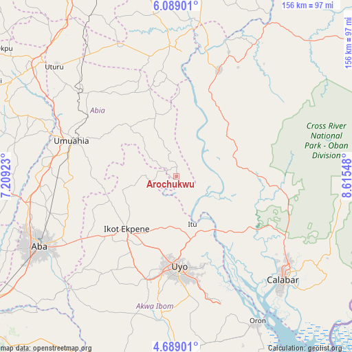
Arochukwu GPS coordinates[2]
5° 23' 21.876" North, 7° 54' 44.46" East
| Map corner | latitude | longitude |
|---|---|---|
| Upper-left | 6.08901°, | 7.20923° |
| Center: | 5.38941°, | 7.91235° |
| Lower-right: | 4.68901°, | 8.61548° |
| Map W x H: | 155.7×155.7 km | = 96.7×96.7mi |
| max Lat: | 13.7543° ⇑90.8% North |
| Arochukwu: | 5.38941° |
| min Lat: | ⇓9.2% South 4.31231° |
| min Long | Arochukwu | max Long |
| 2.73333° | 7.91235° | 14.46552° |
| W 61.9%⇐ | ⇒38.1% E |
Elevation
Elevation of Arochukwu is 82 m = 269 ft, and this is 214.5 m = 704 ft below average elevation for this country.
| Max E: |
1599 m = 5246 ft | 80.1% |
| Avg. | 296.5 m = 973 ft | |
| Arochukwu | 82 m = 269 ft | |
Min E: |
2 m = 7 ft | 19.9% |
See also: Nigeria elevation on elevation.city.
Geographical zone
Arochukwu is located in North Torrid zone (between Equator and Tropic of Cancer). Distance of Equator is 599.2 km =372.3 mi to South.| Distance of | km | miles | from Arochukwu |
|---|---|---|---|
| North Pole | 9407.8 | 5845.7 | to North |
| Arctic Circle | 6801.9 | 4226.5 | to North |
| Tropic Cancer | 2006.7 | 1246.9 | to North |
| Equator | 599.2 | 372.3 | to South |


Nearby cities:
15 places around Arochukwu: (largest is in red/bold)
• Afaha Ikot Ebak
40.8 km =25.4 mi,  223°
223°
• Akpet Central
33.2 km =20.6 mi,  39°
39°
• Bende
36.1 km =22.4 mi,  301°
301°
• Ebem Ohafia
28.4 km =17.6 mi,  341°
341°
• Ibiaku Ntok Okpo
24 km =14.9 mi,  248°
248°
• Idu
41.6 km =25.8 mi,  163°
163°
• Ikot Ekpene
31.8 km =19.8 mi, 223°
• Isiala Oboro
38.1 km =23.7 mi,  272°
272°
• Itu
22.4 km =13.9 mi, 159°
• Nguzu Edda
42 km =26.1 mi,  345°
345°
• Nto Edino
40.1 km =24.9 mi, 248°
• Odoro Ikpe
18.1 km =11.2 mi,  259°
259°
• Ohafia-Ifigh
27.4 km =17 mi, 336°
• Oko Ita
22 km =13.7 mi,  184°
184°
• Uyo
37.7 km =23.4 mi, 176°
Sources, notices
• [Note1] Compared only with cities in Nigeria existing in our database
• [Src1] Map data: © OpenStreetMap contributors (CC-BY-SA)
• [Src2] Other city data from geonames.org with taken over terms of usage.
• [Src3] Geographical zone / Annual Mean Temperature by Robert A. Rohde @ Wikipedia
