Kvam geodata
Kvam (Oppland) is a populated place; located in Norway in Europe/Oslo (GMT+2) time zone. With population of 844 people, there are 348 cities with bigger population in this country. Compared to other cities in Norway, 61.4% of cities are located further ↓South; 54.3% of cities are located further →East and 88.9% of cities have lower elevation than Kvam. Note1


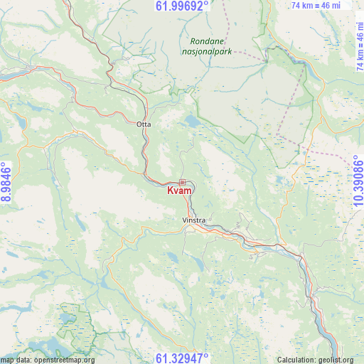
Kvam GPS coordinates[2]
61° 39' 54" North, 9° 41' 15.828" East
| Map corner | latitude | longitude |
|---|---|---|
| Upper-left | 61.99692°, | 8.9846° |
| Center: | 61.665°, | 9.68773° |
| Lower-right: | 61.32947°, | 10.39086° |
| Map W x H: | 74.2×74.2 km | = 46.1×46.1mi |
| max Lat: | 71.04137° ⇑38.6% North |
| Kvam: | 61.665° |
| min Lat: | ⇓61.4% South 58.0274° |
| min Long | Kvam | max Long |
| 4.71485° | 9.68773° | 31.11066° |
| W 45.7%⇐ | ⇒54.3% E |
Elevation
Elevation of Kvam is 262 m = 860 ft, and this is 157.8 m = 518 ft above average elevation for this country.
| Max E: |
897 m = 2943 ft | 11.1% |
| Kvam | 262 m 860 ft | |
| Avg. | 104.2 m = 342 ft | |
Min E: |
1 m = 3 ft | 88.9% |
See also: Norway elevation on elevation.city.
Geographical zone
Kvam is located in North temperate zone (between Tropic of Cancer and the Arctic Circle). Distance of this North polar circle is 544.7 km =338.5 mi to North.| Distance of | km | miles | from Kvam |
|---|---|---|---|
| North Pole | 3150.6 | 1957.7 | to North |
| Arctic Circle | 544.7 | 338.5 | to North |
| Tropic Cancer | 4250.6 | 2641.2 | to South |
| Equator | 6856.5 | 4260.4 | to South |


Nearby cities:
15 places around Kvam: (largest is in red/bold)
• Dale
15.9 km =9.9 mi,  320°
320°
• Dombås
54.3 km =33.7 mi,  327°
327°
• Dovre
42.4 km =26.3 mi, 327°
• Folldal
54.4 km =33.8 mi,  17°
17°
• Follebu
59.2 km =36.8 mi,  147°
147°
• Forset
56.9 km =35.4 mi, 154°
• Fossbergom
62 km =38.5 mi,  288°
288°
• Hundorp
18.1 km =11.2 mi,  132°
132°
• Otta
14.3 km =8.9 mi, 325°
• Ringebu
28.2 km =17.5 mi,  122°
122°
• Segalstad
56.1 km =34.9 mi, 148°
• Segalstad bru
56.3 km =35 mi, 149°
• Tretten
50.8 km =31.6 mi,  140°
140°
• Vinstra
8.5 km =5.3 mi,  156°
156°
• Vågåmo
38.9 km =24.2 mi,  306°
306°
Sources, notices
• [Note1] Compared only with cities in Norway existing in our database
• [Src1] Map data: © OpenStreetMap contributors (CC-BY-SA)
• [Src2] Other city data from geonames.org with taken over terms of usage.
• [Src3] Geographical zone / Annual Mean Temperature by Robert A. Rohde @ Wikipedia
