Dale geodata
Dale (Sogn og Fjordane) is a seat of a second-order administrative division; located in Norway in Europe/Oslo (GMT+2) time zone. With population of 988 people, there are 315 cities with bigger population in this country. Compared to other cities in Norway, 59.8% of cities are located further ↓South; 91.9% of cities are located further →East and 77.4% of cities have lower elevation than Dale. Note1


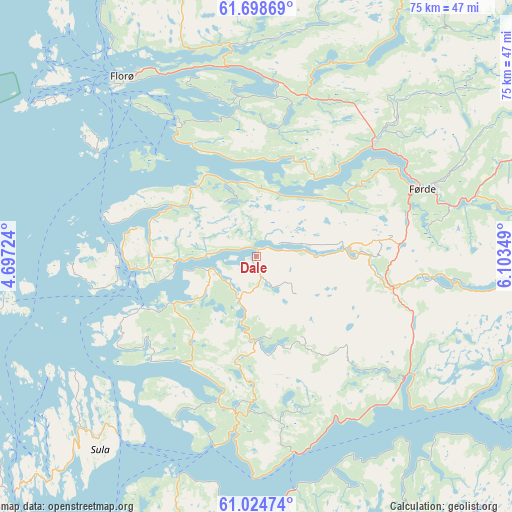
Dale GPS coordinates[2]
61° 21' 48.708" North, 5° 24' 1.296" East
| Map corner | latitude | longitude |
|---|---|---|
| Upper-left | 61.69869°, | 4.69724° |
| Center: | 61.36353°, | 5.40036° |
| Lower-right: | 61.02474°, | 6.10349° |
| Map W x H: | 74.9×74.9 km | = 46.5×46.5mi |
| max Lat: | 71.04137° ⇑40.2% North |
| Dale: | 61.36353° |
| min Lat: | ⇓59.8% South 58.0274° |
| min Long | Dale | max Long |
| 4.71485° | 5.40036° | 31.11066° |
| W 8.1%⇐ | ⇒91.9% E |
Elevation
Elevation of Dale is 160 m = 525 ft, and this is 55.8 m = 183 ft above average elevation for this country.
| Max E: |
897 m = 2943 ft | 22.6% |
| Dale | 160 m 525 ft | |
| Avg. | 104.2 m = 342 ft | |
Min E: |
1 m = 3 ft | 77.4% |
See also: Norway elevation on elevation.city.
Geographical zone
Dale is located in North temperate zone (between Tropic of Cancer and the Arctic Circle). Distance of this North polar circle is 578.2 km =359.3 mi to North.| Distance of | km | miles | from Dale |
|---|---|---|---|
| North Pole | 3184.1 | 1978.5 | to North |
| Arctic Circle | 578.2 | 359.3 | to North |
| Tropic Cancer | 4217.1 | 2620.4 | to South |
| Equator | 6823 | 4239.6 | to South |


Nearby cities:
15 places around Dale: (largest is in red/bold)
• Askvoll
18.1 km =11.2 mi,  264°
264°
• Balestrand
63 km =39.1 mi,  105°
105°
• Eivindvik
45.9 km =28.5 mi,  202°
202°
• Florø
32.7 km =20.3 mi,  323°
323°
• Førde
26.2 km =16.3 mi,  67°
67°
• Hardbakke
43.8 km =27.2 mi,  223°
223°
• Hyllestad
22.1 km =13.7 mi,  194°
194°
• Høyanger
39.7 km =24.7 mi, 113°
• Masfjorden
63 km =39.1 mi,  184°
184°
• Mo
64.6 km =40.1 mi,  160°
160°
• Naustdal
23.5 km =14.6 mi,  45°
45°
• Sandane
62.7 km =39 mi,  43°
43°
• Sande
21.6 km =13.4 mi,  101°
101°
• Skei
61.8 km =38.4 mi, 68°
• Svelgen
45.5 km =28.3 mi,  352°
352°
Sources, notices
• [Note1] Compared only with cities in Norway existing in our database
• [Src1] Map data: © OpenStreetMap contributors (CC-BY-SA)
• [Src2] Other city data from geonames.org with taken over terms of usage.
• [Src3] Geographical zone / Annual Mean Temperature by Robert A. Rohde @ Wikipedia
