Nepalgunj geodata
Nepalgunj (Mid Western) is a populated place; located in Nepal in Asia/Kathmandu (GMT+5.75) time zone. With population of 64,400 people, there are 15 cities with bigger population in this country. Compared to other cities in Nepal, 60.8% of cities are located further ↓South; 87.8% of cities are located further →East and 79.7% of cities have higher elevation than Nepalgunj. Note1


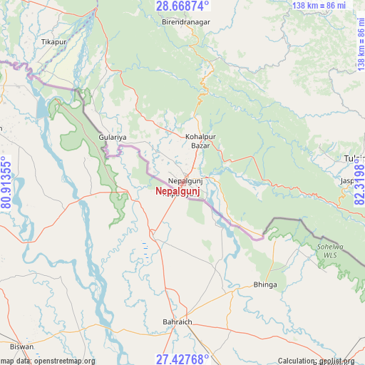
Nepalgunj GPS coordinates[2]
28° 3' 0" North, 81° 37' 0.012" East
| Map corner | latitude | longitude |
|---|---|---|
| Upper-left | 28.66874°, | 80.91355° |
| Center: | 28.05°, | 81.61667° |
| Lower-right: | 27.42768°, | 82.3198° |
| Map W x H: | 138×138 km | = 85.7×85.7mi |
| max Lat: | 30.04651° ⇑39.2% North |
| Nepalgunj: | 28.05° |
| min Lat: | ⇓60.8% South 26.45505° |
| min Long | Nepalgunj | max Long |
| 80.17715° | 81.61667° | 88.09436° |
| W 12.2%⇐ | ⇒87.8% E |
Elevation
Elevation of Nepalgunj is 150 m = 492 ft, and this is 1025.2 m = 3364 ft below average elevation for this country.
| Max E: |
5251 m = 17228 ft | 79.7% |
| Avg. | 1175.2 m = 3856 ft | |
| Nepalgunj | 150 m = 492 ft | |
Min E: |
72 m = 236 ft | 20.3% |
See also: Nepalgunj elevation on elevation.city.
Geographical zone
Nepalgunj is located in North temperate zone (between Tropic of Cancer and the Arctic Circle). Distance of this Northern Tropic circle is 512.9 km =318.7 mi to South.| Distance of | km | miles | from Nepalgunj |
|---|---|---|---|
| North Pole | 6888.2 | 4280.1 | to North |
| Arctic Circle | 4282.3 | 2660.9 | to North |
| Tropic Cancer | 512.9 | 318.7 | to South |
| Equator | 3118.9 | 1938 | to South |


Nearby cities:
15 places around Nepalgunj: (largest is in red/bold)
• Achhām
115.4 km =71.7 mi,  344°
344°
• Bardiyā
38 km =23.6 mi,  317°
317°
• Besisahar
80.7 km =50.1 mi,  75°
75°
• Bhojpur
20.1 km =12.5 mi,  129°
129°
• Birendranagar
61.4 km =38.2 mi,  1°
1°
• Dailekh
88.8 km =55.2 mi,  5°
5°
• Dhangaḍhi̇̄
123.8 km =76.9 mi,  305°
305°
• Dipayal
149.9 km =93.1 mi,  333°
333°
• Gulariyā
31.8 km =19.8 mi,  303°
303°
• Jumla
147 km =91.3 mi,  22°
22°
• Pyūthān
124.4 km =77.3 mi,  88°
88°
• Salyān
65.4 km =40.6 mi,  56°
56°
• Surkhet
54.3 km =33.7 mi, 16°
• Tulsīpur
67.4 km =41.9 mi, 82°
• Ṭikāpur
72.2 km =44.9 mi, 317°
Sources, notices
• [Note1] Compared only with cities in Nepal existing in our database
• [Src1] Map data: © OpenStreetMap contributors (CC-BY-SA)
• [Src2] Other city data from geonames.org with taken over terms of usage.
• [Src3] Geographical zone / Annual Mean Temperature by Robert A. Rohde @ Wikipedia
