Bhojpur geodata
Bhojpur (Mid Western) is a populated place; located in Nepal in Asia/Kathmandu (GMT+5.75) time zone. With population of 2,640 people, there are 53 cities with bigger population in this country. Compared to other cities in Nepal, 55.4% of cities are located further ↓South; 83.8% of cities are located further →East and 82.4% of cities have higher elevation than Bhojpur. Note1


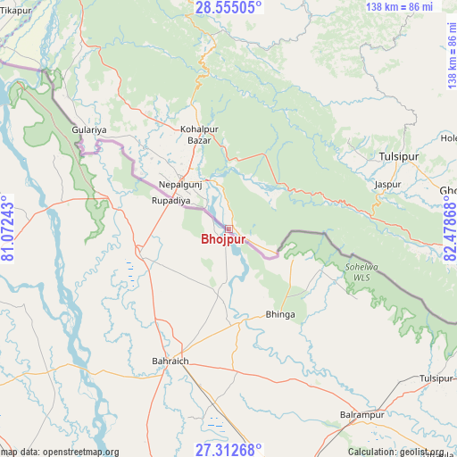
Bhojpur GPS coordinates[2]
27° 56' 8.34" North, 81° 46' 31.98" East
| Map corner | latitude | longitude |
|---|---|---|
| Upper-left | 28.55505°, | 81.07243° |
| Center: | 27.93565°, | 81.77555° |
| Lower-right: | 27.31268°, | 82.47868° |
| Map W x H: | 138.1×138.1 km | = 85.8×85.8mi |
| max Lat: | 30.04651° ⇑44.6% North |
| Bhojpur: | 27.93565° |
| min Lat: | ⇓55.4% South 26.45505° |
| min Long | Bhojpur | max Long |
| 80.17715° | 81.77555° | 88.09436° |
| W 16.2%⇐ | ⇒83.8% E |
Elevation
Elevation of Bhojpur is 132 m = 433 ft, and this is 1043.2 m = 3423 ft below average elevation for this country.
| Max E: |
5251 m = 17228 ft | 82.4% |
| Avg. | 1175.2 m = 3856 ft | |
| Bhojpur | 132 m = 433 ft | |
Min E: |
72 m = 236 ft | 17.6% |
See also: Nepal elevation on elevation.city.
Geographical zone
Bhojpur is located in North temperate zone (between Tropic of Cancer and the Arctic Circle). Distance of this Northern Tropic circle is 500.2 km =310.8 mi to South.| Distance of | km | miles | from Bhojpur |
|---|---|---|---|
| North Pole | 6900.9 | 4288 | to North |
| Arctic Circle | 4295 | 2668.8 | to North |
| Tropic Cancer | 500.2 | 310.8 | to South |
| Equator | 3106.2 | 1930.1 | to South |


Nearby cities:
15 places around Bhojpur: (largest is in red/bold)
• Achhām
132.3 km =82.2 mi,  339°
339°
• Bardiyā
58 km =36 mi,  314°
314°
• Besisahar
70.8 km =44 mi,  62°
62°
• Birendranagar
75.4 km =46.9 mi,  349°
349°
• Butwāl
166.6 km =103.5 mi,  99°
99°
• Dailekh
101.2 km =62.9 mi,  356°
356°
• Dhangaḍhi̇̄
143.9 km =89.4 mi, 306°
• Gulariyā
51.8 km =32.2 mi, 305°
• Jumla
154.1 km =95.8 mi,  14°
14°
• Nepalgunj
20.1 km =12.5 mi, 309°
• Pyūthān
110.2 km =68.5 mi,  81°
81°
• Salyān
62.6 km =38.9 mi,  38°
38°
• Surkhet
64.7 km =40.2 mi,  0°
0°
• Tulsīpur
55.6 km =34.5 mi,  67°
67°
• Ṭikāpur
92.1 km =57.2 mi,  315°
315°
Sources, notices
• [Note1] Compared only with cities in Nepal existing in our database
• [Src1] Map data: © OpenStreetMap contributors (CC-BY-SA)
• [Src2] Other city data from geonames.org with taken over terms of usage.
• [Src3] Geographical zone / Annual Mean Temperature by Robert A. Rohde @ Wikipedia
