Surkhet geodata
Surkhet (Mid Western) is a seat of a third-order administrative division; located in Nepal in Asia/Kathmandu (GMT+5.75) time zone. In our database, there are 62 cities with bigger population. Compared to other cities in Nepal, 77% of cities are located further ↓South; 82.4% of cities are located further →East and 55.4% of cities have higher elevation than Surkhet. Note1


Surkhet GPS coordinates[2]
28° 31' 2.856" North, 81° 46' 43.32" East
| Map corner | latitude | longitude |
|---|---|---|
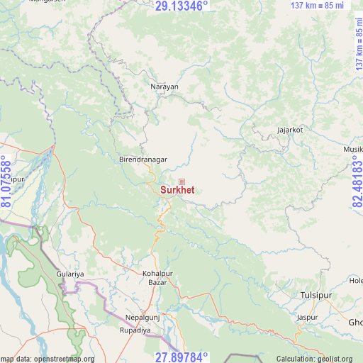
| Upper-left | 29.13346°, | 81.07558° |
| Center: | 28.51746°, | 81.7787° |
| Lower-right: | 27.89784°, | 82.48183° |
| Map W x H: | 137.4×137.4 km | = 85.4×85.4mi |
| max Lat: | 30.04651° ⇑23% North |
| Surkhet: | 28.51746° |
| min Lat: | ⇓77% South 26.45505° |
| min Long | Surkhet | max Long |
| 80.17715° | 81.7787° | 88.09436° |
| W 17.6%⇐ | ⇒82.4% E |
Elevation
Elevation of Surkhet is 874 m = 2867 ft, and this is 301.2 m = 988 ft below average elevation for this country.
| Max E: |
5251 m = 17228 ft | 55.4% |
| Avg. | 1175.2 m = 3856 ft | |
| Surkhet | 874 m = 2867 ft | |
Min E: |
72 m = 236 ft | 44.6% |
See also: Nepal elevation on elevation.city.
Geographical zone
Surkhet is located in North temperate zone (between Tropic of Cancer and the Arctic Circle). Distance of this Northern Tropic circle is 564.9 km =351 mi to South.| Distance of | km | miles | from Surkhet |
|---|---|---|---|
| North Pole | 6836.2 | 4247.8 | to North |
| Arctic Circle | 4230.3 | 2628.6 | to North |
| Tropic Cancer | 564.9 | 351 | to South |
| Equator | 3170.8 | 1970.2 | to South |


Nearby cities:
15 places around Surkhet: (largest is in red/bold)
• Achhām
75.4 km =46.9 mi,  321°
321°
• Bardiyā
48.1 km =29.9 mi,  239°
239°
• Besisahar
69.6 km =43.2 mi,  116°
116°
• Bhojpur
64.7 km =40.2 mi,  180°
180°
• Birendranagar
17 km =10.6 mi,  303°
303°
• Dailekh
37 km =23 mi,  349°
349°
• Dhangaḍhi̇̄
117.8 km =73.2 mi,  279°
279°
• Dipayal
116.2 km =72.2 mi, 315°
• Gulariyā
54.8 km =34.1 mi,  230°
230°
• Jumla
93 km =57.8 mi,  25°
25°
• Nepalgunj
54.3 km =33.7 mi,  196°
196°
• Pyūthān
118.3 km =73.5 mi,  113°
113°
• Salyān
41.3 km =25.7 mi, 111°
• Tulsīpur
66.5 km =41.3 mi,  130°
130°
• Ṭikāpur
64.6 km =40.1 mi,  271°
271°
Sources, notices
• [Note1] Compared only with cities in Nepal existing in our database
• [Src1] Map data: © OpenStreetMap contributors (CC-BY-SA)
• [Src2] Other city data from geonames.org with taken over terms of usage.
• [Src3] Geographical zone / Annual Mean Temperature by Robert A. Rohde @ Wikipedia
