Puerto Obaldía geodata
Puerto Obaldía (Guna Yala) is a seat of a third-order administrative division; located in Panama in America/Panama (GMT-5) time zone. With population of 533 people, there are 457 cities with bigger population in this country. Compared to other cities in Panama, 68.6% of cities are located further ↓South; 99.9% of cities are located further ←West and 91.8% of cities have higher elevation than Puerto Obaldía. Note1


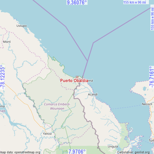
Puerto Obaldía GPS coordinates[2]
8° 39' 58.752" North, 77° 25' 9.192" West
| Map corner | latitude | longitude |
|---|---|---|
| Upper-left | 9.36076°, | -78.12235° |
| Center: | 8.66632°, | -77.41922° |
| Lower-right: | 7.9706°, | -76.7161° |
| Map W x H: | 154.6×154.6 km | = 96.1×96.1mi |
| max Lat: | 9.60898° ⇑31.4% North |
| Puerto Obaldía: | 8.66632° |
| min Lat: | ⇓68.6% South 7.26534° |
| min Long | Puerto Obaldía | max Long |
| -82.91275° | -77.41922° | -77.38965° |
| W 99.9%⇐ | ⇒0.099999999999994% E |
Elevation
Elevation of Puerto Obaldía is 11 m = 36 ft, and this is 161.1 m = 529 ft below average elevation for this country.
| Max E: |
2103 m = 6900 ft | 91.8% |
| Avg. | 172.1 m = 565 ft | |
| Puerto Obaldía | 11 m = 36 ft | |
Min E: |
-1 m = -3 ft | 8.2% |
See also: Panama elevation on elevation.city.
Geographical zone
Puerto Obaldía is located in North Torrid zone (between Equator and Tropic of Cancer). Distance of Equator is 963.6 km =598.8 mi to South.| Distance of | km | miles | from Puerto Obaldía |
|---|---|---|---|
| North Pole | 9043.5 | 5619.4 | to North |
| Arctic Circle | 6437.6 | 4000.1 | to North |
| Tropic Cancer | 1642.3 | 1020.5 | to North |
| Equator | 963.6 | 598.8 | to South |


Nearby cities:
15 places around Puerto Obaldía: (largest is in red/bold)
• Armila
3.6 km =2.2 mi,  263°
263°
• Coetupo
39.7 km =24.7 mi,  310°
310°
• Corozal
55.3 km =34.4 mi,  200°
200°
• El Real de Santa María
67.7 km =42.1 mi,  208°
208°
• Lajas Blancas
51.4 km =31.9 mi,  237°
237°
• Metetí
64.3 km =40 mi,  253°
253°
• Mortí
58.5 km =36.4 mi,  290°
290°
• Mortí
64.2 km =39.9 mi, 287°
• Mulatupo
48 km =29.8 mi, 310°
• Pueblo Nuevo
65 km =40.4 mi, 207°
• Tubualá
43.9 km =27.3 mi, 310°
• Unión Chocó
66 km =41 mi,  191°
191°
• Villa Darién
66.1 km =41.1 mi, 258°
• Yape
66.1 km =41.1 mi, 197°
• Yaviza
64 km =39.8 mi, 208°
Sources, notices
• [Note1] Compared only with cities in Panama existing in our database
• [Src1] Map data: © OpenStreetMap contributors (CC-BY-SA)
• [Src2] Other city data from geonames.org with taken over terms of usage.
• [Src3] Geographical zone / Annual Mean Temperature by Robert A. Rohde @ Wikipedia
