Mulatupo geodata
Mulatupo (Guna Yala) is a populated place; located in Panama in America/Panama (GMT-5) time zone. With population of 1,303 people, there are 186 cities with bigger population in this country. Compared to other cities in Panama, 81.2% of cities are located further ↓South; 98.2% of cities are located further ←West and 97.4% of cities have higher elevation than Mulatupo. Note1


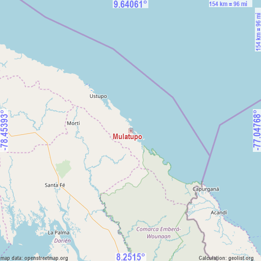
Mulatupo GPS coordinates[2]
8° 56' 48.192" North, 77° 45' 2.88" West
| Map corner | latitude | longitude |
|---|---|---|
| Upper-left | 9.64061°, | -78.45393° |
| Center: | 8.94672°, | -77.7508° |
| Lower-right: | 8.2515°, | -77.04768° |
| Map W x H: | 154.5×154.5 km | = 96×96mi |
| max Lat: | 9.60898° ⇑18.8% North |
| Mulatupo: | 8.94672° |
| min Lat: | ⇓81.2% South 7.26534° |
| min Long | Mulatupo | max Long |
| -82.91275° | -77.7508° | -77.38965° |
| W 98.2%⇐ | ⇒1.8% E |
Elevation
Elevation of Mulatupo is 5 m = 16 ft, and this is 167.1 m = 548 ft below average elevation for this country.
| Max E: |
2103 m = 6900 ft | 97.4% |
| Avg. | 172.1 m = 565 ft | |
| Mulatupo | 5 m = 16 ft | |
Min E: |
-1 m = -3 ft | 2.6% |
See also: Panama elevation on elevation.city.
Geographical zone
Mulatupo is located in North Torrid zone (between Equator and Tropic of Cancer). Distance of Equator is 994.8 km =618.1 mi to South.| Distance of | km | miles | from Mulatupo |
|---|---|---|---|
| North Pole | 9012.3 | 5600 | to North |
| Arctic Circle | 6406.4 | 3980.8 | to North |
| Tropic Cancer | 1611.1 | 1001.1 | to North |
| Equator | 994.8 | 618.1 | to South |


Nearby cities:
15 places around Mulatupo: (largest is in red/bold)
• Achutupo
38.2 km =23.7 mi,  317°
317°
• Agua Fría Número Uno
50 km =31.1 mi,  258°
258°
• Ailigandí
43.6 km =27.1 mi, 315°
• Armila
45.6 km =28.3 mi,  133°
133°
• Cañazas
52.3 km =32.5 mi, 264°
• Coetupo
8.2 km =5.1 mi, 129°
• Mortí
21 km =13 mi,  240°
240°
• Mortí
27.3 km =17 mi, 244°
• Puerto Obaldía
48 km =29.8 mi, 130°
• Quebrada Honda
52.7 km =32.7 mi,  228°
228°
• Tubualá
4.1 km =2.5 mi, 134°
• Ualá
34.3 km =21.3 mi,  277°
277°
• Ustupo
28.1 km =17.5 mi, 316°
• Villa Darién
52.8 km =32.8 mi,  212°
212°
• Zapallal
53.2 km =33.1 mi, 231°
Sources, notices
• [Note1] Compared only with cities in Panama existing in our database
• [Src1] Map data: © OpenStreetMap contributors (CC-BY-SA)
• [Src2] Other city data from geonames.org with taken over terms of usage.
• [Src3] Geographical zone / Annual Mean Temperature by Robert A. Rohde @ Wikipedia
