Coetupo geodata
Coetupo (Guna Yala) is a populated place; located in Panama in America/Panama (GMT-5) time zone. With population of 930 people, there are 273 cities with bigger population in this country. Compared to other cities in Panama, 79.3% of cities are located further ↓South; 98.9% of cities are located further ←West and 98.6% of cities have higher elevation than Coetupo. Note1


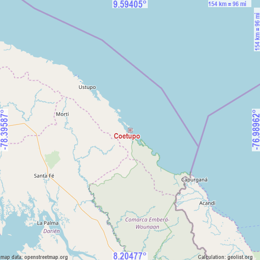
Coetupo GPS coordinates[2]
8° 54' 0.252" North, 77° 41' 33.864" West
| Map corner | latitude | longitude |
|---|---|---|
| Upper-left | 9.59405°, | -78.39587° |
| Center: | 8.90007°, | -77.69274° |
| Lower-right: | 8.20477°, | -76.98962° |
| Map W x H: | 154.5×154.5 km | = 96×96mi |
| max Lat: | 9.60898° ⇑20.7% North |
| Coetupo: | 8.90007° |
| min Lat: | ⇓79.3% South 7.26534° |
| min Long | Coetupo | max Long |
| -82.91275° | -77.69274° | -77.38965° |
| W 98.9%⇐ | ⇒1.1% E |
Elevation
Elevation of Coetupo is 4 m = 13 ft, and this is 168.1 m = 552 ft below average elevation for this country.
| Max E: |
2103 m = 6900 ft | 98.6% |
| Avg. | 172.1 m = 565 ft | |
| Coetupo | 4 m = 13 ft | |
Min E: |
-1 m = -3 ft | 1.4% |
See also: Panama elevation on elevation.city.
Geographical zone
Coetupo is located in North Torrid zone (between Equator and Tropic of Cancer). Distance of Equator is 989.6 km =614.9 mi to South.| Distance of | km | miles | from Coetupo |
|---|---|---|---|
| North Pole | 9017.5 | 5603.2 | to North |
| Arctic Circle | 6411.6 | 3984 | to North |
| Tropic Cancer | 1616.3 | 1004.3 | to North |
| Equator | 989.6 | 614.9 | to South |


Nearby cities:
15 places around Coetupo: (largest is in red/bold)
• Achutupo
46.3 km =28.8 mi,  315°
315°
• Ailigandí
51.8 km =32.2 mi,  314°
314°
• Armila
37.4 km =23.2 mi,  134°
134°
• Lajas Blancas
55.5 km =34.5 mi,  193°
193°
• Metetí
54.6 km =33.9 mi,  215°
215°
• Mortí
25.2 km =15.7 mi,  257°
257°
• Mortí
31.7 km =19.7 mi, 258°
• Mulatupo
8.2 km =5.1 mi, 309°
• Puerto Obaldía
39.7 km =24.7 mi, 130°
• Quebrada Honda
54.8 km =34.1 mi,  237°
237°
• Tubualá
4.1 km =2.5 mi,  304°
304°
• Ualá
41.5 km =25.8 mi,  283°
283°
• Ustupo
36.3 km =22.6 mi, 315°
• Villa Darién
52.5 km =32.6 mi, 221°
• Zapallal
55.5 km =34.5 mi, 239°
Sources, notices
• [Note1] Compared only with cities in Panama existing in our database
• [Src1] Map data: © OpenStreetMap contributors (CC-BY-SA)
• [Src2] Other city data from geonames.org with taken over terms of usage.
• [Src3] Geographical zone / Annual Mean Temperature by Robert A. Rohde @ Wikipedia
