Isla Tigre geodata
Isla Tigre (Guna Yala) is a populated place; located in Panama in America/Panama (GMT-5) time zone. With population of 817 people, there are 315 cities with bigger population in this country. Compared to other cities in Panama, 97.5% of cities are located further ↓South; 93.6% of cities are located further ←West and 99.7% of cities have higher elevation than Isla Tigre. Note1


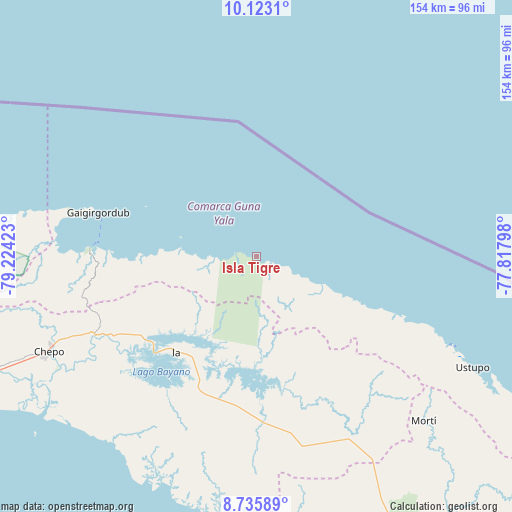
Isla Tigre GPS coordinates[2]
9° 25' 48.684" North, 78° 31' 15.96" West
| Map corner | latitude | longitude |
|---|---|---|
| Upper-left | 10.1231°, | -79.22423° |
| Center: | 9.43019°, | -78.5211° |
| Lower-right: | 8.73589°, | -77.81798° |
| Map W x H: | 154.2×154.2 km | = 95.8×95.8mi |
| max Lat: | 9.60898° ⇑2.5% North |
| Isla Tigre: | 9.43019° |
| min Lat: | ⇓97.5% South 7.26534° |
| min Long | Isla Tigre | max Long |
| -82.91275° | -78.5211° | -77.38965° |
| W 93.6%⇐ | ⇒6.4% E |
Elevation
Elevation of Isla Tigre is 1 m = 3 ft, and this is 171.1 m = 561 ft below average elevation for this country.
| Max E: |
2103 m = 6900 ft | 99.7% |
| Avg. | 172.1 m = 565 ft | |
| Isla Tigre | 1 m = 3 ft | |
Min E: |
-1 m = -3 ft | 0.3% |
See also: Panama elevation on elevation.city.
Geographical zone
Isla Tigre is located in North Torrid zone (between Equator and Tropic of Cancer). Distance of Equator is 1048.5 km =651.5 mi to South.| Distance of | km | miles | from Isla Tigre |
|---|---|---|---|
| North Pole | 8958.5 | 5566.6 | to North |
| Arctic Circle | 6352.6 | 3947.3 | to North |
| Tropic Cancer | 1557.4 | 967.7 | to North |
| Equator | 1048.5 | 651.5 | to South |


Nearby cities:
15 places around Isla Tigre: (largest is in red/bold)
• Achutupo
64 km =39.8 mi,  113°
113°
• Ailigandí
58.6 km =36.4 mi, 112°
• Cartí Sugdup
48.2 km =30 mi,  274°
274°
• Cañazas
67.5 km =41.9 mi,  151°
151°
• Cañita
47.1 km =29.3 mi,  240°
240°
• El Porvenir
49.2 km =30.6 mi,  286°
286°
• El Progreso
67.8 km =42.1 mi,  254°
254°
• Icantí
29.9 km =18.6 mi,  216°
216°
• Ipetí
51.4 km =31.9 mi,  178°
178°
• Narganá
7.4 km =4.6 mi,  282°
282°
• Playón Chico
34.3 km =21.3 mi, 112°
• San Ignacio de Tupile
43.4 km =27 mi, 111°
• Tortí
58 km =36 mi,  167°
167°
• Tubualá
57 km =35.4 mi, 279°
• Unión Santeña
67.7 km =42.1 mi,  192°
192°
Sources, notices
• [Note1] Compared only with cities in Panama existing in our database
• [Src1] Map data: © OpenStreetMap contributors (CC-BY-SA)
• [Src2] Other city data from geonames.org with taken over terms of usage.
• [Src3] Geographical zone / Annual Mean Temperature by Robert A. Rohde @ Wikipedia
