San Ignacio de Tupile geodata
San Ignacio de Tupile (Guna Yala) is a populated place; located in Panama in America/Panama (GMT-5) time zone. With population of 1,429 people, there are 165 cities with bigger population in this country. Compared to other cities in Panama, 94.3% of cities are located further ↓South; 96% of cities are located further ←West and 98.6% of cities have higher elevation than San Ignacio de Tupile. Note1
Current local time in San Ignacio de Tupile:
06:48 PM, ThursdayDifference from your time zone: hours


San Ignacio de Tupile GPS coordinates[2]
9° 17' 20.58" North, 78° 9' 7.416" West
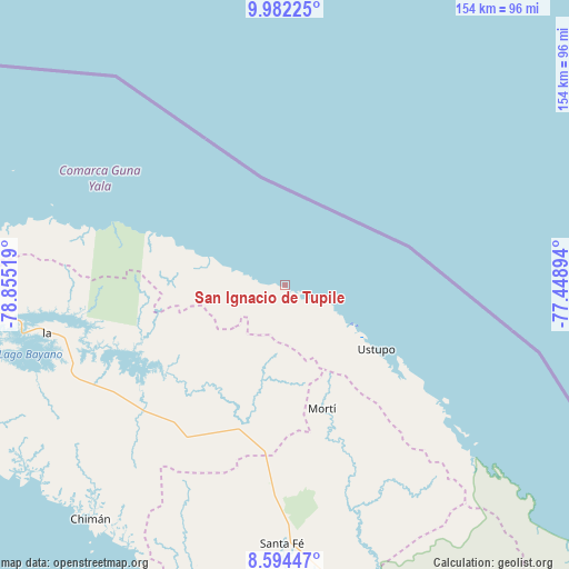
| Map corner | latitude | longitude |
|---|---|---|
| Upper-left | 9.98225°, | -78.85519° |
| Center: | 9.28905°, | -78.15206° |
| Lower-right: | 8.59447°, | -77.44894° |
| Map W x H: | 154.3×154.3 km | = 95.9×95.9mi |
| max Lat: | 9.60898° ⇑5.7% North |
| San Ignacio de Tupile: | 9.28905° |
| min Lat: | ⇓94.3% South 7.26534° |
| min Long | San Ignacio de | max Long |
| -82.91275° | -78.15206° | -77.38965° |
| W 96%⇐ | ⇒4% E |
Elevation
Elevation of San Ignacio de Tupile is 4 m = 13 ft, and this is 168.1 m = 552 ft below average elevation for this country.
| Max E: |
2103 m = 6900 ft | 98.6% |
| Avg. | 172.1 m = 565 ft | |
| San Ignacio de Tupile | 4 m = 13 ft | |
Min E: |
-1 m = -3 ft | 1.4% |
See also: Panama elevation on elevation.city.
Geographical zone
San Ignacio de Tupile is located in North Torrid zone (between Equator and Tropic of Cancer). Distance of Equator is 1032.8 km =641.8 mi to South.| Distance of | km | miles | from San Ignacio de Tupile |
|---|---|---|---|
| North Pole | 8974.2 | 5576.3 | to North |
| Arctic Circle | 6368.3 | 3957.1 | to North |
| Tropic Cancer | 1573.1 | 977.5 | to North |
| Equator | 1032.8 | 641.8 | to South |


Nearby cities:
15 places around San Ignacio de Tupile: (largest is in red/bold)
• Achutupo
20.7 km =12.9 mi,  119°
119°
• Agua Fría Número Uno
48.1 km =29.9 mi,  185°
185°
• Ailigandí
15.2 km =9.4 mi, 116°
• Cañazas
44.1 km =27.4 mi, 190°
• Ipetí
52.6 km =32.7 mi,  227°
227°
• Isla Tigre
43.4 km =27 mi,  291°
291°
• Mortí
53.3 km =33.1 mi,  158°
158°
• Mortí
55 km =34.2 mi,  151°
151°
• Mulatupo
58.2 km =36.2 mi,  130°
130°
• Narganá
50.7 km =31.5 mi, 289°
• Platanilla
57.3 km =35.6 mi,  206°
206°
• Playón Chico
9.2 km =5.7 mi, 285°
• Tortí
49.5 km =30.8 mi, 214°
• Ualá
35.2 km =21.9 mi, 163°
• Ustupo
30.4 km =18.9 mi, 125°
Sources, notices
• [Note1] Compared only with cities in Panama existing in our database
• [Src1] Map data: © OpenStreetMap contributors (CC-BY-SA)
• [Src2] Other city data from geonames.org with taken over terms of usage.
• [Src3] Geographical zone / Annual Mean Temperature by Robert A. Rohde @ Wikipedia
