Achutupo geodata
Achutupo (Guna Yala) is a populated place; located in Panama in America/Panama (GMT-5) time zone. With population of 1,753 people, there are 136 cities with bigger population in this country. Compared to other cities in Panama, 91.4% of cities are located further ↓South; 97.2% of cities are located further ←West and 97.4% of cities have higher elevation than Achutupo. Note1


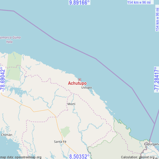
Achutupo GPS coordinates[2]
9° 11' 53.772" North, 77° 59' 14.244" West
| Map corner | latitude | longitude |
|---|---|---|
| Upper-left | 9.89166°, | -78.69042° |
| Center: | 9.19827°, | -77.98729° |
| Lower-right: | 8.50352°, | -77.28417° |
| Map W x H: | 154.3×154.3 km | = 95.9×95.9mi |
| max Lat: | 9.60898° ⇑8.6% North |
| Achutupo: | 9.19827° |
| min Lat: | ⇓91.4% South 7.26534° |
| min Long | Achutupo | max Long |
| -82.91275° | -77.98729° | -77.38965° |
| W 97.2%⇐ | ⇒2.8% E |
Elevation
Elevation of Achutupo is 5 m = 16 ft, and this is 167.1 m = 548 ft below average elevation for this country.
| Max E: |
2103 m = 6900 ft | 97.4% |
| Avg. | 172.1 m = 565 ft | |
| Achutupo | 5 m = 16 ft | |
Min E: |
-1 m = -3 ft | 2.6% |
See also: Panama elevation on elevation.city.
Geographical zone
Achutupo is located in North Torrid zone (between Equator and Tropic of Cancer). Distance of Equator is 1022.8 km =635.5 mi to South.| Distance of | km | miles | from Achutupo |
|---|---|---|---|
| North Pole | 8984.3 | 5582.6 | to North |
| Arctic Circle | 6378.4 | 3963.4 | to North |
| Tropic Cancer | 1583.2 | 983.8 | to North |
| Equator | 1022.8 | 635.5 | to South |


Nearby cities:
15 places around Achutupo: (largest is in red/bold)
• Agua Fría Número Uno
44.3 km =27.5 mi,  211°
211°
• Ailigandí
5.5 km =3.4 mi,  306°
306°
• Cañazas
42.3 km =26.3 mi,  218°
218°
• Coetupo
46.3 km =28.8 mi,  135°
135°
• Ipetí
62.3 km =38.7 mi,  245°
245°
• Mortí
39.2 km =24.4 mi,  168°
168°
• Mortí
39.6 km =24.6 mi,  178°
178°
• Mulatupo
38.2 km =23.7 mi, 137°
• Platanilla
60 km =37.3 mi,  226°
226°
• Playón Chico
29.7 km =18.5 mi,  295°
295°
• San Ignacio de Tupile
20.7 km =12.9 mi, 299°
• Tortí
55.3 km =34.4 mi,  236°
236°
• Tubualá
42.3 km =26.3 mi, 136°
• Ualá
25 km =15.5 mi,  198°
198°
• Ustupo
10 km =6.2 mi, 138°
Sources, notices
• [Note1] Compared only with cities in Panama existing in our database
• [Src1] Map data: © OpenStreetMap contributors (CC-BY-SA)
• [Src2] Other city data from geonames.org with taken over terms of usage.
• [Src3] Geographical zone / Annual Mean Temperature by Robert A. Rohde @ Wikipedia
