Playón Chico geodata
Playón Chico (Guna Yala) is a populated place; located in Panama in America/Panama (GMT-5) time zone. With population of 2,042 people, there are 116 cities with bigger population in this country. Compared to other cities in Panama, 95.2% of cities are located further ↓South; 94.8% of cities are located further ←West and 97.4% of cities have higher elevation than Playón Chico. Note1


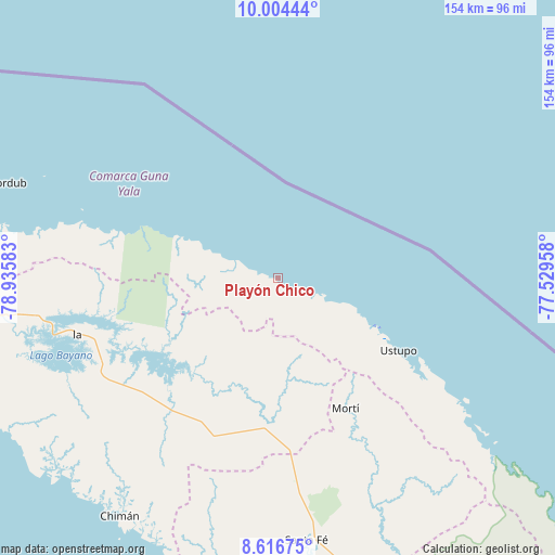
Playón Chico GPS coordinates[2]
9° 18' 40.608" North, 78° 13' 57.72" West
| Map corner | latitude | longitude |
|---|---|---|
| Upper-left | 10.00444°, | -78.93583° |
| Center: | 9.31128°, | -78.2327° |
| Lower-right: | 8.61675°, | -77.52958° |
| Map W x H: | 154.3×154.3 km | = 95.9×95.9mi |
| max Lat: | 9.60898° ⇑4.8% North |
| Playón Chico: | 9.31128° |
| min Lat: | ⇓95.2% South 7.26534° |
| min Long | Playón Chico | max Long |
| -82.91275° | -78.2327° | -77.38965° |
| W 94.8%⇐ | ⇒5.2% E |
Elevation
Elevation of Playón Chico is 5 m = 16 ft, and this is 167.1 m = 548 ft below average elevation for this country.
| Max E: |
2103 m = 6900 ft | 97.4% |
| Avg. | 172.1 m = 565 ft | |
| Playón Chico | 5 m = 16 ft | |
Min E: |
-1 m = -3 ft | 2.6% |
See also: Panama elevation on elevation.city.
Geographical zone
Playón Chico is located in North Torrid zone (between Equator and Tropic of Cancer). Distance of Equator is 1035.3 km =643.3 mi to South.| Distance of | km | miles | from Playón Chico |
|---|---|---|---|
| North Pole | 8971.7 | 5574.8 | to North |
| Arctic Circle | 6365.9 | 3955.6 | to North |
| Tropic Cancer | 1570.6 | 975.9 | to North |
| Equator | 1035.3 | 643.3 | to South |


Nearby cities:
15 places around Playón Chico: (largest is in red/bold)
• Achutupo
29.7 km =18.5 mi,  115°
115°
• Agua Fría Número Uno
50.5 km =31.4 mi,  175°
175°
• Ailigandí
24.3 km =15.1 mi,  112°
112°
• Cañazas
45.9 km =28.5 mi, 178°
• Icantí
50.6 km =31.4 mi,  257°
257°
• Ipetí
48.4 km =30.1 mi,  218°
218°
• Isla Tigre
34.3 km =21.3 mi,  292°
292°
• Mortí
59.3 km =36.8 mi,  151°
151°
• Mortí
61.7 km =38.3 mi, 145°
• Narganá
41.5 km =25.8 mi, 290°
• Platanilla
56.3 km =35 mi,  197°
197°
• San Ignacio de Tupile
9.2 km =5.7 mi, 105°
• Tortí
47.3 km =29.4 mi, 203°
• Ualá
40.8 km =25.4 mi, 152°
• Ustupo
39.2 km =24.4 mi, 120°
Sources, notices
• [Note1] Compared only with cities in Panama existing in our database
• [Src1] Map data: © OpenStreetMap contributors (CC-BY-SA)
• [Src2] Other city data from geonames.org with taken over terms of usage.
• [Src3] Geographical zone / Annual Mean Temperature by Robert A. Rohde @ Wikipedia
