Ualá geodata
Ualá (Darién) is a populated place; located in Panama in America/Panama (GMT-5) time zone. With population of 532 people, there are 458 cities with bigger population in this country. Compared to other cities in Panama, 83.4% of cities are located further ↓South; 96.7% of cities are located further ←West and 55.5% of cities have lower elevation than Ualá. Note1


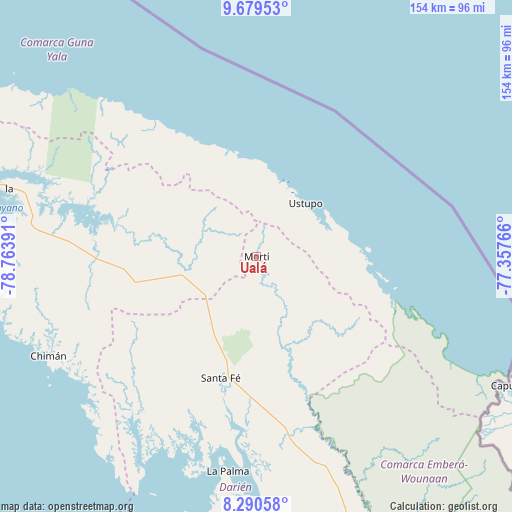
Ualá GPS coordinates[2]
8° 59' 8.592" North, 78° 3' 38.808" West
| Map corner | latitude | longitude |
|---|---|---|
| Upper-left | 9.67953°, | -78.76391° |
| Center: | 8.98572°, | -78.06078° |
| Lower-right: | 8.29058°, | -77.35766° |
| Map W x H: | 154.4×154.4 km | = 95.9×95.9mi |
| max Lat: | 9.60898° ⇑16.6% North |
| Ualá: | 8.98572° |
| min Lat: | ⇓83.4% South 7.26534° |
| min Long | Ualá | max Long |
| -82.91275° | -78.06078° | -77.38965° |
| W 96.7%⇐ | ⇒3.3% E |
Elevation
Elevation of Ualá is 90 m = 295 ft, and this is 82.1 m = 269 ft below average elevation for this country.
| Max E: |
2103 m = 6900 ft | 44.5% |
| Avg. | 172.1 m = 565 ft | |
| Ualá | 90 m = 295 ft | |
Min E: |
-1 m = -3 ft | 55.5% |
See also: Panama elevation on elevation.city.
Geographical zone
Ualá is located in North Torrid zone (between Equator and Tropic of Cancer). Distance of Equator is 999.1 km =620.8 mi to South.| Distance of | km | miles | from Ualá |
|---|---|---|---|
| North Pole | 9007.9 | 5597.2 | to North |
| Arctic Circle | 6402.1 | 3978.1 | to North |
| Tropic Cancer | 1606.8 | 998.4 | to North |
| Equator | 999.1 | 620.8 | to South |


Nearby cities:
15 places around Ualá: (largest is in red/bold)
• Achutupo
25 km =15.5 mi,  18°
18°
• Agua Fría Número Uno
20.6 km =12.8 mi,  226°
226°
• Ailigandí
27.2 km =16.9 mi,  7°
7°
• Cañazas
20.4 km =12.7 mi,  241°
241°
• Mortí
18.5 km =11.5 mi,  149°
149°
• Mortí
21.6 km =13.4 mi,  133°
133°
• Mulatupo
34.3 km =21.3 mi,  97°
97°
• Platanilla
39.6 km =24.6 mi, 243°
• Quebrada Honda
39.4 km =24.5 mi,  188°
188°
• San Ignacio de Tupile
35.2 km =21.9 mi,  343°
343°
• Santa Fé
38.4 km =23.9 mi,  196°
196°
• Tortí
38.5 km =23.9 mi,  259°
259°
• Tubualá
37.7 km =23.4 mi, 101°
• Ustupo
21.9 km =13.6 mi,  42°
42°
• Zapallal
38.2 km =23.7 mi, 191°
Sources, notices
• [Note1] Compared only with cities in Panama existing in our database
• [Src1] Map data: © OpenStreetMap contributors (CC-BY-SA)
• [Src2] Other city data from geonames.org with taken over terms of usage.
• [Src3] Geographical zone / Annual Mean Temperature by Robert A. Rohde @ Wikipedia
