Rodriguez geodata
Rodriguez (Calabarzon) is a seat of a third-order administrative division; located in Philippines in Asia/Manila (GMT+8) time zone. With population of 134,432 people, there are 70 cities with bigger population in this country. Compared to other cities in Philippines, 75.6% of cities are located further ↓South; 71.7% of cities are located further →East and 89.3% of cities have lower elevation than Rodriguez. Note1
Administrative division(s):
- Level 1: Calabarzon
- Level 2: Province of Rizal
- Level 3: Rodriguez (Montalban)


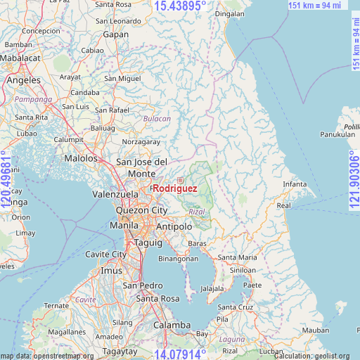
Rodriguez GPS coordinates[2]
14° 45' 36.396" North, 121° 11' 59.748" East
| Map corner | latitude | longitude |
|---|---|---|
| Upper-left | 15.43895°, | 120.49681° |
| Center: | 14.76011°, | 121.19993° |
| Lower-right: | 14.07914°, | 121.90306° |
| Map W x H: | 151.2×151.2 km | = 94×94mi |
| max Lat: | 20.78733° ⇑24.4% North |
| Rodriguez: | 14.76011° |
| min Lat: | ⇓75.6% South 4.65442° |
| min Long | Rodriguez | max Long |
| 117.04868° | 121.19993° | 126.58417° |
| W 28.3%⇐ | ⇒71.7% E |
Elevation
Elevation of Rodriguez is 215 m = 705 ft, and this is 127.1 m = 417 ft above average elevation for this country.
| Max E: |
2262 m = 7421 ft | 10.7% |
| Rodriguez | 215 m 705 ft | |
| Avg. | 87.9 m = 288 ft | |
Min E: |
-2 m = -7 ft | 89.3% |
See also: Rodriguez elevation on elevation.city.
Geographical zone
Rodriguez is located in North Torrid zone (between Equator and Tropic of Cancer). Distance of this Northern Tropic circle is 964.7 km =599.4 mi to North.| Distance of | km | miles | from Rodriguez |
|---|---|---|---|
| North Pole | 8365.9 | 5198.3 | to North |
| Arctic Circle | 5760 | 3579.1 | to North |
| Tropic Cancer | 964.7 | 599.4 | to North |
| Equator | 1641.2 | 1019.8 | to South |


Nearby cities:
15 places around Rodriguez: (largest is in red/bold)
• Antipolo
17.1 km =10.6 mi,  209°
209°
• Bagong Pagasa
21 km =13 mi,  238°
238°
• Balasing
22.7 km =14.1 mi,  297°
297°
• Bituñgol
22.5 km =14 mi,  307°
307°
• Cainta
21.8 km =13.5 mi,  202°
202°
• Calumpang
19.3 km =12 mi,  217°
217°
• Loma de Gato
21.8 km =13.5 mi,  278°
278°
• Malanday
9.5 km =5.9 mi,  231°
231°
• Norzagaray
23.3 km =14.5 mi,  316°
316°
• Pinugay
19.4 km =12.1 mi,  159°
159°
• Quezon City
20.3 km =12.6 mi, 232°
• San Jose del Monte
17.7 km =11 mi,  289°
289°
• San Mateo
10.7 km =6.6 mi, 230°
• Taytay
23.5 km =14.6 mi, 197°
• Teresa
22.2 km =13.8 mi,  174°
174°
Sources, notices
• [Note1] Compared only with cities in Philippines existing in our database
• [Src1] Map data: © OpenStreetMap contributors (CC-BY-SA)
• [Src2] Other city data from geonames.org with taken over terms of usage.
• [Src3] Geographical zone / Annual Mean Temperature by Robert A. Rohde @ Wikipedia
