Lakki geodata
Lakki (Khyber Pakhtunkhwa) is a seat of a second-order administrative division; located in Pakistan in Asia/Karachi (GMT+5) time zone. With population of 36,391 people, there are 171 cities with bigger population in this country. Compared to other cities in Pakistan, 77.4% of cities are located further ↓South; 56% of cities are located further →East and 73.1% of cities have lower elevation than Lakki. Note1


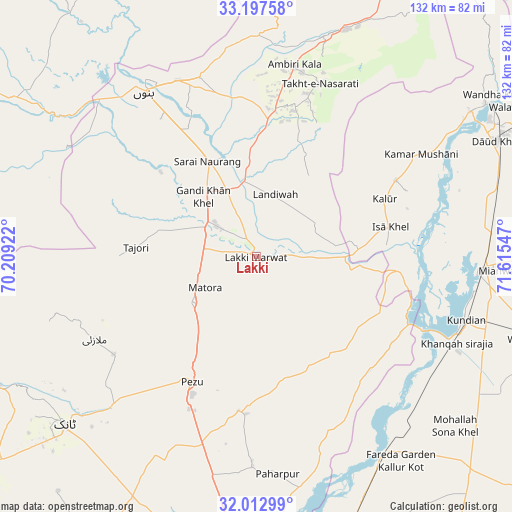
Lakki GPS coordinates[2]
32° 36' 26.064" North, 70° 54' 44.424" East
| Map corner | latitude | longitude |
|---|---|---|
| Upper-left | 33.19758°, | 70.20922° |
| Center: | 32.60724°, | 70.91234° |
| Lower-right: | 32.01299°, | 71.61547° |
| Map W x H: | 131.7×131.7 km | = 81.8×81.8mi |
| max Lat: | 36.32162° ⇑22.6% North |
| Lakki: | 32.60724° |
| min Lat: | ⇓77.4% South 24.14422° |
| min Long | Lakki | max Long |
| 61.74573° | 70.91234° | 75.63372° |
| W 44%⇐ | ⇒56% E |
Elevation
Elevation of Lakki is 267 m = 876 ft, and this is 78 m = 256 ft below average elevation for this country.
| Max E: |
2732 m = 8963 ft | 26.9% |
| Avg. | 345 m = 1132 ft | |
| Lakki | 267 m = 876 ft | |
Min E: |
3 m = 10 ft | 73.1% |
See also: Pakistan elevation on elevation.city.
Geographical zone
Lakki is located in North temperate zone (between Tropic of Cancer and the Arctic Circle). Distance of this Northern Tropic circle is 1019.7 km =633.6 mi to South.| Distance of | km | miles | from Lakki |
|---|---|---|---|
| North Pole | 6381.5 | 3965.3 | to North |
| Arctic Circle | 3775.6 | 2346 | to North |
| Tropic Cancer | 1019.7 | 633.6 | to South |
| Equator | 3625.6 | 2252.8 | to South |


Nearby cities:
15 places around Lakki: (largest is in red/bold)
• Bannu
51 km =31.7 mi,  325°
325°
• Daud Khel
68.4 km =42.5 mi,  64°
64°
• Dera Ismail Khan
86.3 km =53.6 mi,  180°
180°
• Gulishah Kach
54.1 km =33.6 mi,  277°
277°
• Harnoli
70.4 km =43.7 mi,  121°
121°
• Kalabagh
71.2 km =44.2 mi, 56°
• Kalur Kot
60.3 km =37.5 mi,  146°
146°
• Kamar Mushani
49.6 km =30.8 mi, 58°
• Karak
59.1 km =36.7 mi,  16°
16°
• Kundian
55.7 km =34.6 mi,  107°
107°
• Mianwali
57.8 km =35.9 mi,  93°
93°
• Paharpur
56.1 km =34.9 mi,  174°
174°
• Sarai Naurang
27.2 km =16.9 mi, 333°
• Shorkot
77.6 km =48.2 mi, 182°
• Tank
66 km =41 mi,  228°
228°
Sources, notices
• [Note1] Compared only with cities in Pakistan existing in our database
• [Src1] Map data: © OpenStreetMap contributors (CC-BY-SA)
• [Src2] Other city data from geonames.org with taken over terms of usage.
• [Src3] Geographical zone / Annual Mean Temperature by Robert A. Rohde @ Wikipedia
