Biały Bór geodata
Biały Bór (West Pomerania) is a seat of a third-order administrative division; located in Poland in Europe/Warsaw (GMT+2) time zone. With population of 2,209 people, there are 1354 cities with bigger population in this country. Compared to other cities in Poland, 93.1% of cities are located further ↓South; 86.9% of cities are located further →East and 55.3% of cities have higher elevation than Biały Bór. Note1


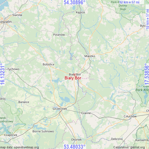
Biały Bór GPS coordinates[2]
53° 53' 48.12" North, 16° 50' 7.548" East
| Map corner | latitude | longitude |
|---|---|---|
| Upper-left | 54.30896°, | 16.13231° |
| Center: | 53.8967°, | 16.83543° |
| Lower-right: | 53.48033°, | 17.53856° |
| Map W x H: | 92.1×92.1 km | = 57.2×57.2mi |
| max Lat: | 54.83135° ⇑6.9% North |
| Biały Bór: | 53.8967° |
| min Lat: | ⇓93.1% South 49.21328° |
| min Long | Biały Bór | max Long |
| 14.20249° | 16.83543° | 24.03723° |
| W 13.1%⇐ | ⇒86.9% E |
Elevation
Elevation of Biały Bór is 158 m = 518 ft, and this is 33.4 m = 110 ft below average elevation for this country.
| Max E: |
974 m = 3196 ft | 55.3% |
| Avg. | 191.4 m = 628 ft | |
| Biały Bór | 158 m = 518 ft | |
Min E: |
-3 m = -10 ft | 44.7% |
See also: Poland elevation on elevation.city.
Geographical zone
Biały Bór is located in North temperate zone (between Tropic of Cancer and the Arctic Circle). Distance of this North polar circle is 1408.4 km =875.1 mi to North.| Distance of | km | miles | from Biały Bór |
|---|---|---|---|
| North Pole | 4014.3 | 2494.4 | to North |
| Arctic Circle | 1408.4 | 875.1 | to North |
| Tropic Cancer | 3386.8 | 2104.5 | to South |
| Equator | 5992.8 | 3723.8 | to South |


Nearby cities:
15 places around Biały Bór: (largest is in red/bold)
• Barwice
35.7 km =22.2 mi,  241°
241°
• Bobolice
17.4 km =10.8 mi,  291°
291°
• Czarne
24.6 km =15.3 mi,  164°
164°
• Grzmiąca
27.1 km =16.8 mi,  255°
255°
• Koczała
15.1 km =9.4 mi,  86°
86°
• Konarzyny
36.6 km =22.7 mi,  102°
102°
• Miastko
15.2 km =9.4 mi,  39°
39°
• Polanów
26.6 km =16.5 mi,  338°
338°
• Przechlewo
29.4 km =18.3 mi,  111°
111°
• Rzeczenica
23.6 km =14.7 mi,  130°
130°
• Sitno
28.8 km =17.9 mi,  202°
202°
• Szczecinek
22.8 km =14.2 mi, 203°
• Trzebielino
37.5 km =23.3 mi,  25°
25°
• Tychowo
38 km =23.6 mi,  275°
275°
• Żółtnica
24.8 km =15.4 mi,  183°
183°
Sources, notices
• [Note1] Compared only with cities in Poland existing in our database
• [Src1] Map data: © OpenStreetMap contributors (CC-BY-SA)
• [Src2] Other city data from geonames.org with taken over terms of usage.
• [Src3] Geographical zone / Annual Mean Temperature by Robert A. Rohde @ Wikipedia
