Rzewnie geodata
Rzewnie (Mazovia) is a seat of a third-order administrative division; located in Poland in Europe/Warsaw (GMT+2) time zone. With population of 293 people, there are 3623 cities with bigger population in this country. Compared to other cities in Poland, 81.3% of cities are located further ↓South; 77.4% of cities are located further ←West and 84.1% of cities have higher elevation than Rzewnie. Note1


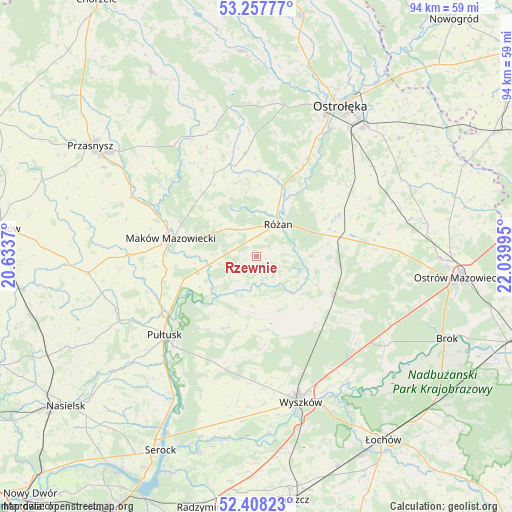
Rzewnie GPS coordinates[2]
52° 50' 6.288" North, 21° 20' 12.552" East
| Map corner | latitude | longitude |
|---|---|---|
| Upper-left | 53.25777°, | 20.6337° |
| Center: | 52.83508°, | 21.33682° |
| Lower-right: | 52.40823°, | 22.03995° |
| Map W x H: | 94.5×94.5 km | = 58.7×58.7mi |
| max Lat: | 54.83135° ⇑18.7% North |
| Rzewnie: | 52.83508° |
| min Lat: | ⇓81.3% South 49.21328° |
| min Long | Rzewnie | max Long |
| 14.20249° | 21.33682° | 24.03723° |
| W 77.4%⇐ | ⇒22.6% E |
Elevation
Elevation of Rzewnie is 91 m = 299 ft, and this is 100.4 m = 329 ft below average elevation for this country.
| Max E: |
974 m = 3196 ft | 84.1% |
| Avg. | 191.4 m = 628 ft | |
| Rzewnie | 91 m = 299 ft | |
Min E: |
-3 m = -10 ft | 15.9% |
See also: Poland elevation on elevation.city.
Geographical zone
Rzewnie is located in North temperate zone (between Tropic of Cancer and the Arctic Circle). Distance of this North polar circle is 1526.5 km =948.5 mi to North.| Distance of | km | miles | from Rzewnie |
|---|---|---|---|
| North Pole | 4132.4 | 2567.8 | to North |
| Arctic Circle | 1526.5 | 948.5 | to North |
| Tropic Cancer | 3268.8 | 2031.1 | to South |
| Equator | 5874.7 | 3650.4 | to South |


Nearby cities:
15 places around Rzewnie: (largest is in red/bold)
• Czerwonka
10.4 km =6.5 mi,  307°
307°
• Długosiodło
19.1 km =11.9 mi,  115°
115°
• Goworowo
16.4 km =10.2 mi,  63°
63°
• Karniewo
23.4 km =14.5 mi,  270°
270°
• Maków Mazowiecki
16.2 km =10.1 mi,  281°
281°
• Młynarze
14.2 km =8.8 mi,  20°
20°
• Obryte
14.5 km =9 mi,  203°
203°
• Psary
16.6 km =10.3 mi,  216°
216°
• Pułtusk
22.6 km =14 mi,  229°
229°
• Płoniawy-Bramura
23.8 km =14.8 mi, 311°
• Rząśnik
13.7 km =8.5 mi,  171°
171°
• Różan
6.9 km =4.3 mi,  31°
31°
• Sypniewo
19.1 km =11.9 mi,  354°
354°
• Szelków
8 km =5 mi, 269°
• Wąsewo
23 km =14.3 mi,  79°
79°
Sources, notices
• [Note1] Compared only with cities in Poland existing in our database
• [Src1] Map data: © OpenStreetMap contributors (CC-BY-SA)
• [Src2] Other city data from geonames.org with taken over terms of usage.
• [Src3] Geographical zone / Annual Mean Temperature by Robert A. Rohde @ Wikipedia
