Czerwonka geodata
Czerwonka (Mazovia) is a seat of a third-order administrative division; located in Poland in Europe/Warsaw (GMT+2) time zone. With population of 150 people, there are 3647 cities with bigger population in this country. Compared to other cities in Poland, 82.2% of cities are located further ↓South; 75.8% of cities are located further ←West and 74.5% of cities have higher elevation than Czerwonka. Note1


Czerwonka GPS coordinates[2]
52° 53' 33.144" North, 21° 12' 53.784" East
| Map corner | latitude | longitude |
|---|---|---|
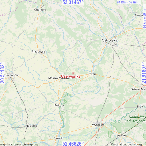
| Upper-left | 53.31467°, | 20.51182° |
| Center: | 52.89254°, | 21.21494° |
| Lower-right: | 52.46626°, | 21.91807° |
| Map W x H: | 94.3×94.3 km | = 58.6×58.6mi |
| max Lat: | 54.83135° ⇑17.8% North |
| Czerwonka: | 52.89254° |
| min Lat: | ⇓82.2% South 49.21328° |
| min Long | Czerwonka | max Long |
| 14.20249° | 21.21494° | 24.03723° |
| W 75.8%⇐ | ⇒24.2% E |
Elevation
Elevation of Czerwonka is 112 m = 367 ft, and this is 79.4 m = 260 ft below average elevation for this country.
| Max E: |
974 m = 3196 ft | 74.5% |
| Avg. | 191.4 m = 628 ft | |
| Czerwonka | 112 m = 367 ft | |
Min E: |
-3 m = -10 ft | 25.5% |
See also: Poland elevation on elevation.city.
Geographical zone
Czerwonka is located in North temperate zone (between Tropic of Cancer and the Arctic Circle). Distance of this North polar circle is 1520.1 km =944.5 mi to North.| Distance of | km | miles | from Czerwonka |
|---|---|---|---|
| North Pole | 4126 | 2563.8 | to North |
| Arctic Circle | 1520.1 | 944.5 | to North |
| Tropic Cancer | 3275.2 | 2035.1 | to South |
| Equator | 5881.1 | 3654.3 | to South |


Nearby cities:
15 places around Czerwonka: (largest is in red/bold)
• Goworowo
22.9 km =14.2 mi,  87°
87°
• Karniewo
16.4 km =10.2 mi,  247°
247°
• Krasne
17 km =10.6 mi,  281°
281°
• Krasnosielc
16.2 km =10.1 mi,  346°
346°
• Maków Mazowiecki
8.3 km =5.2 mi, 248°
• Młynarze
14.8 km =9.2 mi,  62°
62°
• Obryte
19.7 km =12.2 mi,  173°
173°
• Psary
19.9 km =12.4 mi,  184°
184°
• Pułtusk
22.9 km =14.2 mi,  202°
202°
• Płoniawy-Bramura
13.5 km =8.4 mi,  314°
314°
• Rzewnie
10.4 km =6.5 mi,  127°
127°
• Rząśnik
22.4 km =13.9 mi,  152°
152°
• Różan
11.8 km =7.3 mi, 92°
• Sypniewo
14 km =8.7 mi,  26°
26°
• Szelków
6.4 km =4 mi, 178°
Sources, notices
• [Note1] Compared only with cities in Poland existing in our database
• [Src1] Map data: © OpenStreetMap contributors (CC-BY-SA)
• [Src2] Other city data from geonames.org with taken over terms of usage.
• [Src3] Geographical zone / Annual Mean Temperature by Robert A. Rohde @ Wikipedia
