Przyłęk geodata
Przyłęk (Mazovia) is a seat of a third-order administrative division; located in Poland in Europe/Warsaw (GMT+2) time zone. With population of 559 people, there are 3387 cities with bigger population in this country. Compared to other cities in Poland, 53.4% of cities are located further ↓South; 81.7% of cities are located further ←West and 62.4% of cities have higher elevation than Przyłęk. Note1


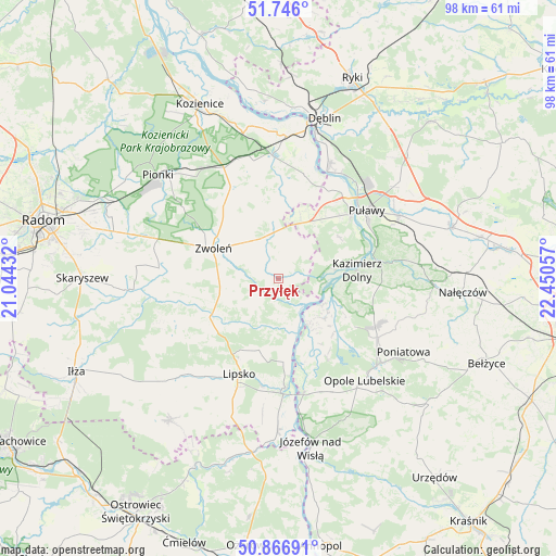
Przyłęk GPS coordinates[2]
51° 18' 30.816" North, 21° 44' 50.784" East
| Map corner | latitude | longitude |
|---|---|---|
| Upper-left | 51.746°, | 21.04432° |
| Center: | 51.30856°, | 21.74744° |
| Lower-right: | 50.86691°, | 22.45057° |
| Map W x H: | 97.7×97.7 km | = 60.7×60.7mi |
| max Lat: | 54.83135° ⇑46.6% North |
| Przyłęk: | 51.30856° |
| min Lat: | ⇓53.4% South 49.21328° |
| min Long | Przyłęk | max Long |
| 14.20249° | 21.74744° | 24.03723° |
| W 81.7%⇐ | ⇒18.3% E |
Elevation
Elevation of Przyłęk is 141 m = 463 ft, and this is 50.4 m = 165 ft below average elevation for this country.
| Max E: |
974 m = 3196 ft | 62.4% |
| Avg. | 191.4 m = 628 ft | |
| Przyłęk | 141 m = 463 ft | |
Min E: |
-3 m = -10 ft | 37.6% |
See also: Poland elevation on elevation.city.
Geographical zone
Przyłęk is located in North temperate zone (between Tropic of Cancer and the Arctic Circle). Distance of this North polar circle is 1696.2 km =1054 mi to North.| Distance of | km | miles | from Przyłęk |
|---|---|---|---|
| North Pole | 4302.1 | 2673.2 | to North |
| Arctic Circle | 1696.2 | 1054 | to North |
| Tropic Cancer | 3099.1 | 1925.7 | to South |
| Equator | 5705 | 3544.9 | to South |


Nearby cities:
15 places around Przyłęk: (largest is in red/bold)
• Chotcza
7.8 km =4.8 mi,  165°
165°
• Ciepielów
13.7 km =8.5 mi,  240°
240°
• Gniewoszów
19 km =11.8 mi,  13°
13°
• Janowiec
10 km =6.2 mi,  80°
80°
• Karczmiska
18.5 km =11.5 mi,  118°
118°
• Kazanów
19.8 km =12.3 mi,  259°
259°
• Kazimierz Dolny
14.5 km =9 mi,  85°
85°
• Lipsko
17.9 km =11.1 mi,  202°
202°
• Policzna
18.4 km =11.4 mi,  332°
332°
• Puławy
19.5 km =12.1 mi,  52°
52°
• Solec Nad Wisłą
19.2 km =11.9 mi,  176°
176°
• Wielgie
19 km =11.8 mi,  247°
247°
• Wilków
10.4 km =6.5 mi, 119°
• Zwoleń
12.3 km =7.6 mi,  295°
295°
• Łagów
6.5 km =4 mi,  2°
2°
Sources, notices
• [Note1] Compared only with cities in Poland existing in our database
• [Src1] Map data: © OpenStreetMap contributors (CC-BY-SA)
• [Src2] Other city data from geonames.org with taken over terms of usage.
• [Src3] Geographical zone / Annual Mean Temperature by Robert A. Rohde @ Wikipedia
