Chotcza geodata
Chotcza (Mazovia) is a seat of a third-order administrative division; located in Poland in Europe/Warsaw (GMT+2) time zone. With population of 270 people, there are 3632 cities with bigger population in this country. Compared to other cities in Poland, 51.9% of cities are located further ↓South; 82.1% of cities are located further ←West and 67.4% of cities have higher elevation than Chotcza. Note1


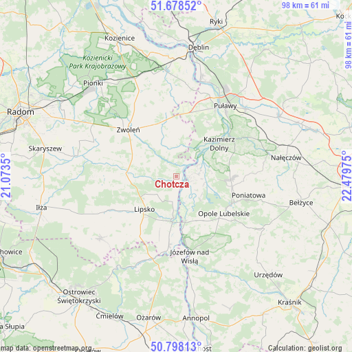
Chotcza GPS coordinates[2]
51° 14' 25.548" North, 21° 46' 35.832" East
| Map corner | latitude | longitude |
|---|---|---|
| Upper-left | 51.67852°, | 21.0735° |
| Center: | 51.24043°, | 21.77662° |
| Lower-right: | 50.79813°, | 22.47975° |
| Map W x H: | 97.9×97.9 km | = 60.8×60.8mi |
| max Lat: | 54.83135° ⇑48.1% North |
| Chotcza: | 51.24043° |
| min Lat: | ⇓51.9% South 49.21328° |
| min Long | Chotcza | max Long |
| 14.20249° | 21.77662° | 24.03723° |
| W 82.1%⇐ | ⇒17.9% E |
Elevation
Elevation of Chotcza is 127 m = 417 ft, and this is 64.4 m = 211 ft below average elevation for this country.
| Max E: |
974 m = 3196 ft | 67.4% |
| Avg. | 191.4 m = 628 ft | |
| Chotcza | 127 m = 417 ft | |
Min E: |
-3 m = -10 ft | 32.6% |
See also: Poland elevation on elevation.city.
Geographical zone
Chotcza is located in North temperate zone (between Tropic of Cancer and the Arctic Circle). Distance of this North polar circle is 1703.8 km =1058.7 mi to North.| Distance of | km | miles | from Chotcza |
|---|---|---|---|
| North Pole | 4309.7 | 2677.9 | to North |
| Arctic Circle | 1703.8 | 1058.7 | to North |
| Tropic Cancer | 3091.5 | 1921 | to South |
| Equator | 5697.4 | 3540.2 | to South |


Nearby cities:
15 places around Chotcza: (largest is in red/bold)
• Ciepielów
14.1 km =8.8 mi,  273°
273°
• Janowiec
12.1 km =7.5 mi,  40°
40°
• Józefów nad Wisłą
22.4 km =13.9 mi,  170°
170°
• Karczmiska
14.3 km =8.9 mi,  94°
94°
• Kazanów
21.9 km =13.6 mi,  280°
280°
• Kazimierz Dolny
15.2 km =9.4 mi,  54°
54°
• Lipsko
12.6 km =7.8 mi,  224°
224°
• Opole Lubelskie
16.9 km =10.5 mi,  127°
127°
• Przyłęk
7.8 km =4.8 mi,  345°
345°
• Solec Nad Wisłą
11.6 km =7.2 mi,  183°
183°
• Wielgie
19.6 km =12.2 mi, 270°
• Wilków
7.4 km =4.6 mi,  70°
70°
• Zwoleń
18.3 km =11.4 mi,  314°
314°
• Łagów
14.2 km =8.8 mi, 352°
• Łaziska
13 km =8.1 mi,  146°
146°
Sources, notices
• [Note1] Compared only with cities in Poland existing in our database
• [Src1] Map data: © OpenStreetMap contributors (CC-BY-SA)
• [Src2] Other city data from geonames.org with taken over terms of usage.
• [Src3] Geographical zone / Annual Mean Temperature by Robert A. Rohde @ Wikipedia
