Policzna geodata
Policzna (Mazovia) is a seat of a third-order administrative division; located in Poland in Europe/Warsaw (GMT+2) time zone. With population of 1,500 people, there are 1837 cities with bigger population in this country. Compared to other cities in Poland, 55.5% of cities are located further ↓South; 80.5% of cities are located further ←West and 54.2% of cities have higher elevation than Policzna. Note1


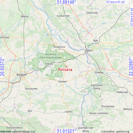
Policzna GPS coordinates[2]
51° 27' 19.62" North, 21° 37' 36.624" East
| Map corner | latitude | longitude |
|---|---|---|
| Upper-left | 51.89148°, | 20.92372° |
| Center: | 51.45545°, | 21.62684° |
| Lower-right: | 51.01521°, | 22.32997° |
| Map W x H: | 97.4×97.4 km | = 60.5×60.5mi |
| max Lat: | 54.83135° ⇑44.5% North |
| Policzna: | 51.45545° |
| min Lat: | ⇓55.5% South 49.21328° |
| min Long | Policzna | max Long |
| 14.20249° | 21.62684° | 24.03723° |
| W 80.5%⇐ | ⇒19.5% E |
Elevation
Elevation of Policzna is 161 m = 528 ft, and this is 30.4 m = 100 ft below average elevation for this country.
| Max E: |
974 m = 3196 ft | 54.2% |
| Avg. | 191.4 m = 628 ft | |
| Policzna | 161 m = 528 ft | |
Min E: |
-3 m = -10 ft | 45.8% |
See also: Poland elevation on elevation.city.
Geographical zone
Policzna is located in North temperate zone (between Tropic of Cancer and the Arctic Circle). Distance of this North polar circle is 1679.9 km =1043.8 mi to North.| Distance of | km | miles | from Policzna |
|---|---|---|---|
| North Pole | 4285.8 | 2663.1 | to North |
| Arctic Circle | 1679.9 | 1043.8 | to North |
| Tropic Cancer | 3115.4 | 1935.8 | to South |
| Equator | 5721.3 | 3555 | to South |


Nearby cities:
15 places around Policzna: (largest is in red/bold)
• Dęblin
19.2 km =11.9 mi,  53°
53°
• Garbatka-Letnisko
3.3 km =2.1 mi,  340°
340°
• Gniewoszów
13 km =8.1 mi,  80°
80°
• Gózd
19.2 km =11.9 mi,  243°
243°
• Janików
13.2 km =8.2 mi,  346°
346°
• Jedlnia-Letnisko
20.4 km =12.7 mi,  262°
262°
• Kobylnica
21.4 km =13.3 mi, 350°
• Kozienice
15.2 km =9.4 mi, 338°
• Paprotnia
19.7 km =12.2 mi,  7°
7°
• Pionki
12.5 km =7.8 mi,  280°
280°
• Przyłęk
18.4 km =11.4 mi,  152°
152°
• Stężyca
17.2 km =10.7 mi,  35°
35°
• Tczów
19.1 km =11.9 mi,  220°
220°
• Zwoleń
11.4 km =7.1 mi,  193°
193°
• Łagów
13.1 km =8.1 mi,  138°
138°
Sources, notices
• [Note1] Compared only with cities in Poland existing in our database
• [Src1] Map data: © OpenStreetMap contributors (CC-BY-SA)
• [Src2] Other city data from geonames.org with taken over terms of usage.
• [Src3] Geographical zone / Annual Mean Temperature by Robert A. Rohde @ Wikipedia
