Garbatka-Letnisko geodata
Garbatka-Letnisko (Mazovia) is a seat of a third-order administrative division; located in Poland in Europe/Warsaw (GMT+2) time zone. With population of 3,295 people, there are 970 cities with bigger population in this country. Compared to other cities in Poland, 56% of cities are located further ↓South; 80.3% of cities are located further ←West and 57.1% of cities have higher elevation than Garbatka-Letnisko. Note1


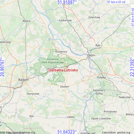
Garbatka-Letnisko GPS coordinates[2]
51° 28' 59.52" North, 21° 36' 38.844" East
| Map corner | latitude | longitude |
|---|---|---|
| Upper-left | 51.91897°, | 20.90767° |
| Center: | 51.4832°, | 21.61079° |
| Lower-right: | 51.04323°, | 22.31392° |
| Map W x H: | 97.4×97.4 km | = 60.5×60.5mi |
| max Lat: | 54.83135° ⇑44% North |
| Garbatka-Letnisko: | 51.4832° |
| min Lat: | ⇓56% South 49.21328° |
| min Long | Garbatka-Letnis | max Long |
| 14.20249° | 21.61079° | 24.03723° |
| W 80.3%⇐ | ⇒19.7% E |
Elevation
Elevation of Garbatka-Letnisko is 153 m = 502 ft, and this is 38.4 m = 126 ft below average elevation for this country.
| Max E: |
974 m = 3196 ft | 57.1% |
| Avg. | 191.4 m = 628 ft | |
| Garbatka-Letnisko | 153 m = 502 ft | |
Min E: |
-3 m = -10 ft | 42.9% |
See also: Poland elevation on elevation.city.
Geographical zone
Garbatka-Letnisko is located in North temperate zone (between Tropic of Cancer and the Arctic Circle). Distance of this North polar circle is 1676.8 km =1041.9 mi to North.| Distance of | km | miles | from Garbatka-Letnisko |
|---|---|---|---|
| North Pole | 4282.7 | 2661.1 | to North |
| Arctic Circle | 1676.8 | 1041.9 | to North |
| Tropic Cancer | 3118.5 | 1937.7 | to South |
| Equator | 5724.4 | 3557 | to South |


Nearby cities:
15 places around Garbatka-Letnisko: (largest is in red/bold)
• Dęblin
18.5 km =11.5 mi,  62°
62°
• Gniewoszów
14 km =8.7 mi,  94°
94°
• Gózd
19.8 km =12.3 mi,  234°
234°
• Janików
10 km =6.2 mi,  348°
348°
• Jedlnia-Letnisko
20 km =12.4 mi,  253°
253°
• Kobylnica
18.2 km =11.3 mi, 352°
• Kozienice
11.9 km =7.4 mi,  338°
338°
• Paprotnia
16.8 km =10.4 mi,  12°
12°
• Pionki
11.2 km =7 mi,  265°
265°
• Podebłocie
19.7 km =12.2 mi,  27°
27°
• Policzna
3.3 km =2.1 mi,  160°
160°
• Stężyca
15.6 km =9.7 mi,  45°
45°
• Tczów
20.9 km =13 mi,  213°
213°
• Zwoleń
14.3 km =8.9 mi,  186°
186°
• Łagów
16.2 km =10.1 mi,  143°
143°
Sources, notices
• [Note1] Compared only with cities in Poland existing in our database
• [Src1] Map data: © OpenStreetMap contributors (CC-BY-SA)
• [Src2] Other city data from geonames.org with taken over terms of usage.
• [Src3] Geographical zone / Annual Mean Temperature by Robert A. Rohde @ Wikipedia
