Frysztak geodata
Frysztak (Subcarpathian) is a seat of a third-order administrative division; located in Poland in Europe/Warsaw (GMT+2) time zone. With population of 950 people, there are 2592 cities with bigger population in this country. Compared to other cities in Poland, 90.2% of cities are located further ↑North; 80.3% of cities are located further ←West and 75.8% of cities have lower elevation than Frysztak. Note1


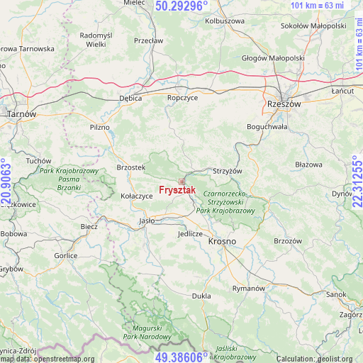
Frysztak GPS coordinates[2]
49° 50' 29.904" North, 21° 36' 33.912" East
| Map corner | latitude | longitude |
|---|---|---|
| Upper-left | 50.29296°, | 20.9063° |
| Center: | 49.84164°, | 21.60942° |
| Lower-right: | 49.38606°, | 22.31255° |
| Map W x H: | 100.8×100.8 km | = 62.6×62.6mi |
| max Lat: | 54.83135° ⇑90.2% North |
| Frysztak: | 49.84164° |
| min Lat: | ⇓9.8% South 49.21328° |
| min Long | Frysztak | max Long |
| 14.20249° | 21.60942° | 24.03723° |
| W 80.3%⇐ | ⇒19.7% E |
Elevation
Elevation of Frysztak is 249 m = 817 ft, and this is 57.6 m = 189 ft above average elevation for this country.
| Max E: |
974 m = 3196 ft | 24.2% |
| Frysztak | 249 m 817 ft | |
| Avg. | 191.4 m = 628 ft | |
Min E: |
-3 m = -10 ft | 75.8% |
See also: Poland elevation on elevation.city.
Geographical zone
Frysztak is located in North temperate zone (between Tropic of Cancer and the Arctic Circle). Distance of this North polar circle is 1859.3 km =1155.3 mi to North.| Distance of | km | miles | from Frysztak |
|---|---|---|---|
| North Pole | 4465.2 | 2774.5 | to North |
| Arctic Circle | 1859.3 | 1155.3 | to North |
| Tropic Cancer | 2936 | 1824.3 | to South |
| Equator | 5541.9 | 3443.6 | to South |


Nearby cities:
15 places around Frysztak: (largest is in red/bold)
• Brzostek
14.8 km =9.2 mi,  286°
286°
• Brzyska
15.9 km =9.9 mi,  262°
262°
• Bystrzyca
17.4 km =10.8 mi,  29°
29°
• Jasło
14.6 km =9.1 mi,  222°
222°
• Jedlicze
14.1 km =8.8 mi,  168°
168°
• Kołaczyce
13.1 km =8.1 mi,  253°
253°
• Odrzykoń
14.7 km =9.1 mi,  140°
140°
• Strzyżów
13.6 km =8.5 mi,  76°
76°
• Tarnowiec
12.5 km =7.8 mi,  190°
190°
• Wielopole Skrzyńskie
11.6 km =7.2 mi,  1°
1°
• Wiśniowa
4.5 km =2.8 mi,  47°
47°
• Wojaszówka
8.4 km =5.2 mi,  148°
148°
• Wróblowa
16.1 km =10 mi, 249°
• Wysoka Strzyżowska
9.5 km =5.9 mi,  97°
97°
• Łęki
5.1 km =3.2 mi,  134°
134°
Sources, notices
• [Note1] Compared only with cities in Poland existing in our database
• [Src1] Map data: © OpenStreetMap contributors (CC-BY-SA)
• [Src2] Other city data from geonames.org with taken over terms of usage.
• [Src3] Geographical zone / Annual Mean Temperature by Robert A. Rohde @ Wikipedia
