Lubomino geodata
Lubomino (Warmia-Masuria) is a populated place; located in Poland in Europe/Warsaw (GMT+2) time zone. With population of 1,194 people, there are 2222 cities with bigger population in this country. Compared to other cities in Poland, 94.9% of cities are located further ↓South; 61.7% of cities are located further ←West and 85.2% of cities have higher elevation than Lubomino. Note1


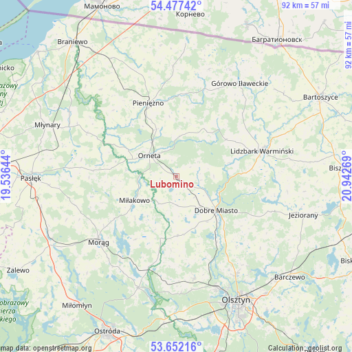
Lubomino GPS coordinates[2]
54° 4' 0.624" North, 20° 14' 22.416" East
| Map corner | latitude | longitude |
|---|---|---|
| Upper-left | 54.47742°, | 19.53644° |
| Center: | 54.06684°, | 20.23956° |
| Lower-right: | 53.65216°, | 20.94269° |
| Map W x H: | 91.8×91.8 km | = 57×57mi |
| max Lat: | 54.83135° ⇑5.1% North |
| Lubomino: | 54.06684° |
| min Lat: | ⇓94.9% South 49.21328° |
| min Long | Lubomino | max Long |
| 14.20249° | 20.23956° | 24.03723° |
| W 61.7%⇐ | ⇒38.3% E |
Elevation
Elevation of Lubomino is 89 m = 292 ft, and this is 102.4 m = 336 ft below average elevation for this country.
| Max E: |
974 m = 3196 ft | 85.2% |
| Avg. | 191.4 m = 628 ft | |
| Lubomino | 89 m = 292 ft | |
Min E: |
-3 m = -10 ft | 14.8% |
See also: Poland elevation on elevation.city.
Geographical zone
Lubomino is located in North temperate zone (between Tropic of Cancer and the Arctic Circle). Distance of this North polar circle is 1389.5 km =863.4 mi to North.| Distance of | km | miles | from Lubomino |
|---|---|---|---|
| North Pole | 3995.4 | 2482.6 | to North |
| Arctic Circle | 1389.5 | 863.4 | to North |
| Tropic Cancer | 3405.8 | 2116.3 | to South |
| Equator | 6011.7 | 3735.5 | to South |


Nearby cities:
15 places around Lubomino: (largest is in red/bold)
• Dobre Miasto
13.6 km =8.5 mi,  130°
130°
• Dywity
29.9 km =18.6 mi,  148°
148°
• Górowo Iławeckie
29.2 km =18.1 mi,  33°
33°
• Janikowo
22.5 km =14 mi,  39°
39°
• Jeziorany
34.6 km =21.5 mi,  107°
107°
• Jonkowo
26.9 km =16.7 mi,  170°
170°
• Lelkowo
28.7 km =17.8 mi,  358°
358°
• Lidzbark Warmiński
23.1 km =14.4 mi,  73°
73°
• Miłakowo
12.7 km =7.9 mi,  239°
239°
• Morąg
26.4 km =16.4 mi,  230°
230°
• Orneta
8.7 km =5.4 mi,  307°
307°
• Pieniężno
20.2 km =12.6 mi,  338°
338°
• Spręcowo
24.5 km =15.2 mi, 148°
• Łukta
30.8 km =19.1 mi,  199°
199°
• Świątki
15.5 km =9.6 mi,  179°
179°
Sources, notices
• [Note1] Compared only with cities in Poland existing in our database
• [Src1] Map data: © OpenStreetMap contributors (CC-BY-SA)
• [Src2] Other city data from geonames.org with taken over terms of usage.
• [Src3] Geographical zone / Annual Mean Temperature by Robert A. Rohde @ Wikipedia
