Turabah geodata
Turabah (Makkah) is a populated place; located in Saudi Arabia in Asia/Riyadh (GMT+3) time zone. With population of 23,235 people, there are 54 cities with bigger population in this country. Compared to other cities in Saudi Arabia, 79.4% of cities are located further ↑North; 75.3% of cities are located further →East and 88.7% of cities have lower elevation than Turabah. Note1


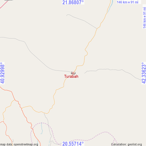
Turabah GPS coordinates[2]
21° 12' 50.616" North, 41° 37' 59.16" East
| Map corner | latitude | longitude |
|---|---|---|
| Upper-left | 21.86807°, | 40.92998° |
| Center: | 21.21406°, | 41.6331° |
| Lower-right: | 20.55714°, | 42.33623° |
| Map W x H: | 145.8×145.8 km | = 90.6×90.6mi |
| max Lat: | 31.67252° ⇑79.4% North |
| Turabah: | 21.21406° |
| min Lat: | ⇓20.6% South 16.57946° |
| min Long | Turabah | max Long |
| 35.69014° | 41.6331° | 54.09599° |
| W 24.7%⇐ | ⇒75.3% E |
Elevation
Elevation of Turabah is 1164 m = 3819 ft, and this is 642.6 m = 2108 ft above average elevation for this country.
| Max E: |
2385 m = 7825 ft | 11.3% |
| Turabah | 1164 m 3819 ft | |
| Avg. | 521.4 m = 1711 ft | |
Min E: |
3 m = 10 ft | 88.7% |
See also: Saudi Arabia elevation on elevation.city.
Geographical zone
Turabah is located in North Torrid zone (between Equator and Tropic of Cancer). Distance of this Northern Tropic circle is 247.1 km =153.5 mi to North.| Distance of | km | miles | from Turabah |
|---|---|---|---|
| North Pole | 7648.3 | 4752.4 | to North |
| Arctic Circle | 5042.4 | 3133.2 | to North |
| Tropic Cancer | 247.1 | 153.5 | to North |
| Equator | 2358.8 | 1465.7 | to South |


Nearby cities:
15 places around Turabah: (largest is in red/bold)
• Afif
327.1 km =203.3 mi,  23°
23°
• Al Bahah
134.7 km =83.7 mi,  187°
187°
• Al Hadā
140.5 km =87.3 mi,  276°
276°
• Al Jumūm
205.2 km =127.5 mi, 282°
• Al Majāridah
234.2 km =145.5 mi,  172°
172°
• Al Mindak
122.8 km =76.3 mi,  197°
197°
• Al Muwayh
136.2 km =84.6 mi,  5°
5°
• An Nimāş
235.6 km =146.4 mi, 167°
• Ash Shafā
137.9 km =85.7 mi,  263°
263°
• Jeddah
254.8 km =158.3 mi, 278°
• Mecca
188.7 km =117.3 mi, 277°
• Qal‘at Bīshah
168.6 km =104.8 mi,  143°
143°
• Rābigh
320.6 km =199.2 mi,  303°
303°
• Tabālah
161.6 km =100.4 mi,  150°
150°
• Ta’if
126.3 km =78.5 mi,  272°
272°
Sources, notices
• [Note1] Compared only with cities in Saudi Arabia existing in our database
• [Src1] Map data: © OpenStreetMap contributors (CC-BY-SA)
• [Src2] Other city data from geonames.org with taken over terms of usage.
• [Src3] Geographical zone / Annual Mean Temperature by Robert A. Rohde @ Wikipedia
