Shendi geodata
Shendi (River Nile) is a populated place; located in Sudan in Africa/Khartoum (GMT+2) time zone. With population of 53,568 people, there are 24 cities with bigger population in this country. Compared to other cities in Sudan, 78.9% of cities are located further ↓South; 66.2% of cities are located further ←West and 81.7% of cities have higher elevation than Shendi. Note1


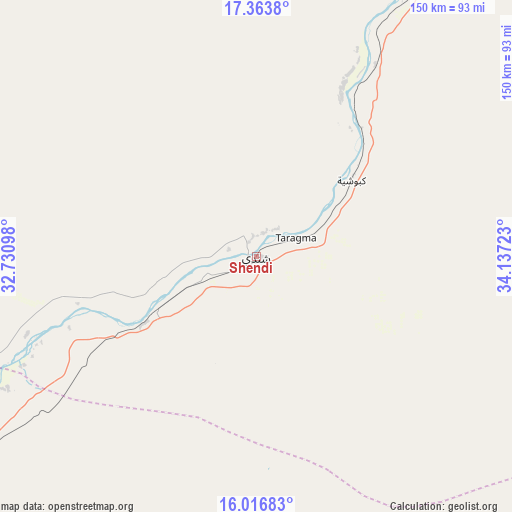
Shendi GPS coordinates[2]
16° 41' 29.4" North, 33° 26' 2.76" East
| Map corner | latitude | longitude |
|---|---|---|
| Upper-left | 17.3638°, | 32.73098° |
| Center: | 16.6915°, | 33.4341° |
| Lower-right: | 16.01683°, | 34.13723° |
| Map W x H: | 149.8×149.8 km | = 93.1×93.1mi |
| max Lat: | 21.06667° ⇑21.1% North |
| Shendi: | 16.6915° |
| min Lat: | ⇓78.9% South 10.55° |
| min Long | Shendi | max Long |
| 22.44725° | 33.4341° | 37.729° |
| W 66.2%⇐ | ⇒33.8% E |
Elevation
Elevation of Shendi is 366 m = 1201 ft, and this is 83.1 m = 273 ft below average elevation for this country.
| Max E: |
1159 m = 3802 ft | 81.7% |
| Avg. | 449.1 m = 1473 ft | |
| Shendi | 366 m = 1201 ft | |
Min E: |
4 m = 13 ft | 18.3% |
See also: Shendi elevation on elevation.city.
Geographical zone
Shendi is located in North Torrid zone (between Equator and Tropic of Cancer). Distance of this Northern Tropic circle is 750 km =466 mi to North.| Distance of | km | miles | from Shendi |
|---|---|---|---|
| North Pole | 8151.1 | 5064.9 | to North |
| Arctic Circle | 5545.3 | 3445.7 | to North |
| Tropic Cancer | 750 | 466 | to North |
| Equator | 1855.9 | 1153.2 | to South |


Nearby cities:
15 places around Shendi: (largest is in red/bold)
• Al Hasaheisa
216.1 km =134.3 mi,  183°
183°
• Al Hilāliyya
195.9 km =121.7 mi,  186°
186°
• Al Kiremit al ‘Arakiyyīn
265.9 km =165.2 mi, 191°
• Al Masallamiyya
235.6 km =146.4 mi, 182°
• Al Qiţena
233 km =144.8 mi,  209°
209°
• Atbara
126.8 km =78.8 mi,  27°
27°
• Berber
158.9 km =98.7 mi,  21°
21°
• Ed Damer
116 km =72.1 mi, 29°
• El Bauga
181.7 km =112.9 mi, 16°
• El Matama
8.5 km =5.3 mi,  283°
283°
• Khartoum
159.2 km =98.9 mi,  217°
217°
• Merowe
262.1 km =162.9 mi,  318°
318°
• Omdurman
154.9 km =96.3 mi, 221°
• Wad Medani
254.8 km =158.3 mi, 177°
• Wad Rāwah
173.1 km =107.6 mi, 190°
Sources, notices
• [Note1] Compared only with cities in Sudan existing in our database
• [Src1] Map data: © OpenStreetMap contributors (CC-BY-SA)
• [Src2] Other city data from geonames.org with taken over terms of usage.
• [Src3] Geographical zone / Annual Mean Temperature by Robert A. Rohde @ Wikipedia
